- Who We Are
- What We Do
- Our Issues
- Our Projects
- Sprawl Retrofit
- Highways to Boulevards
- CNU/ITE Manual
- Health Districts
- The Project for Code Reform
- Lean Urbanism
- LEED for Neighborhood Development
- Missing Middle Housing
- Small-Scale Developers & Builders
- Emergency Response
- HUD HOPE VI
- Rainwater in Context
- Street Networks
- HUD Finance Reform
- Affordable Neighborhoods
- Autonomous Vehicles
- Legacy Projects
- Build Great Places
- Education & Trainings
- Charter Awards
- Annual Congress
- Athena Medals
- Resources
- Get Involved
- Donate
- Membership
- Public Square


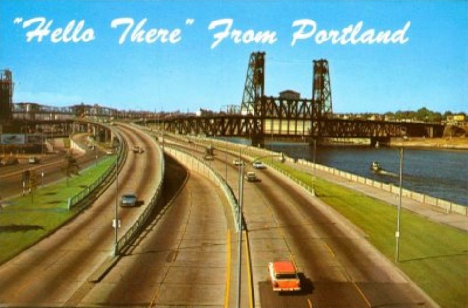
In the history of American freeway teardowns, Portland's Harbor Drive holds an auspicious position. It stands as the first major highway to be intentionally removed. In 1950, Harbor Drive, running adjacent to downtown along the western bank of the Willamette River, became Portland's first limited-access highway, six lanes carrying US Route 99W. As more freeways were built in the city during the 1960s--including Interstate 5 on the eastern bank of the Willamette and Interstate 405, a western bypass around downtown--Harbor Drive became less important as a long-haul freeway route. In the early 1970's, the average daily traffic using Harbor Drive was about 24,000 vehicles, including approximately 2,500 heavy trucks accessing nearby industrial areas.
Highway Removal
In the late 1960s, newly elected Governor Tom McCall pledged his support for the beautification of the west bank of the Willamette River-harkening back to the City Beautiful plans at the turn of the century that envisioned parks and greenways along the river. Alternatives were proposed for the area, initially various tunnel options were discussed but proved too expensive. Citizens, led by the Riverfront for Citizens coalition, called for a park and boulevard option. McCall ultimately backed the boulevard option and in 1974, Harbor Drive was closed for reconstruction.
The Boulevard
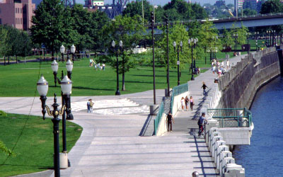
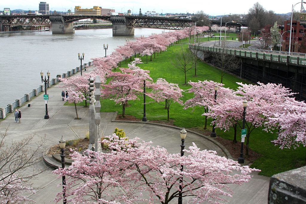
The direct footprint of Harbor Drive was converted into parkland and more park acreage was created by demolishing industrial and commercial buildings that bordered the freeway along Front Avenue. Front Avenue was widened into a landscaped boulevard to handle the local traffic and was later renamed as Naito Parkway. In 1978, construction of the 37-acre Waterfront Park was completed and, in1984, was named after Governor Tom McCall. The city extended Waterfront Park to the south in 1999, doubling the size of the public open space. Due to the success of the park, the city is currently redesigning sections of Naito Parkway to make the boulevard more pedestrian-friendly.
Economic Development
The success of Portland's downtown is widely known-and the demolition of Harbor Drive should take a good portion of credit. Key developments-like Yards at Union Station to the north and RiverPlace to the south-led to a resurgence in downtown housing. The city continues to develop waterfront plans to build on the river as an asset. The Portland Development Commission's Downtown Waterfront Development Strategies Project aims to increase mixed-use development along the length of the downtown and three blocks from the waters' edge. This is in recognition of the dramatic increases in property value that have resulted from the replacement of Harbor Drive with an at-grade boulevard.