Since 1928, the McGrath Highway - between the Charles and Mystic Rivers in Boston - has increased motorists’ travel speed, to the detriment of all other modes. A portion of the highway, the McCarthy Overpass, was elevated in the 1950s, physically separating densely populated East Somerville neighborhoods from each other and the rest of the city. Union Square, Brickbottom, and East Somerville - some of the historic neighborhoods separated by the Overpass - were host to several historic events in America's history. Paul Revere's famous "Midnight Ride" ran through the heart of East Somerville.
Today, the neighborhoods continue to be vibrant cultural centers. Originally settled by the Irish, Italians, French and Canadian immigrants, the neighborhoods' rich culture, good schools, and affordable housing have attracted even more communities resulting in the addition of a vibrant and growing Latin American community. Yet pedestrians and vehicles still struggled to move through confusing intersections beneath the elevated structure from Somerville Avenue to Highland Avenue.
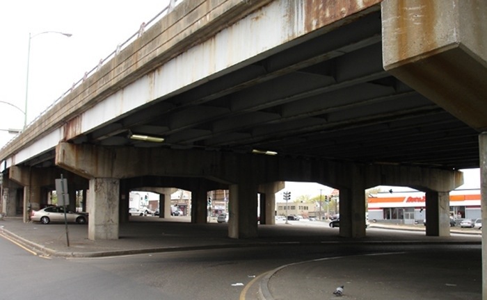
Largely in response to its declining condition and residents’ concerns about the overpass’ affect on health, traffic and livability, Massachusetts Department of Transportation (MassDOT) conducted a Grounding McGrath Study which concluded in the Fall of 2013. While the highway replacement options were all called “boulevards”, community members were dismayed that there was no four-lane option among the proposed designs. The smallest replacement was still a six lane roadway. Existing six lane sections of McGrath located just a half mile away were clear evidence that a smaller footprint would be in keeping with the very dense walkable neighborhoods that abut McGrath.
Based on community concerns and with the encouragement of Somerville Mayor Joe Curtatone, MassDOT in the Summer of 2014 launched the environmental permitting and preliminary design process for the full grounding of McGrath. Noting the communities concerns about a six lane highway, the State has stated it will fairly assess the possibility of going down to four lanes, while not ruling out a five or six lane alternative.
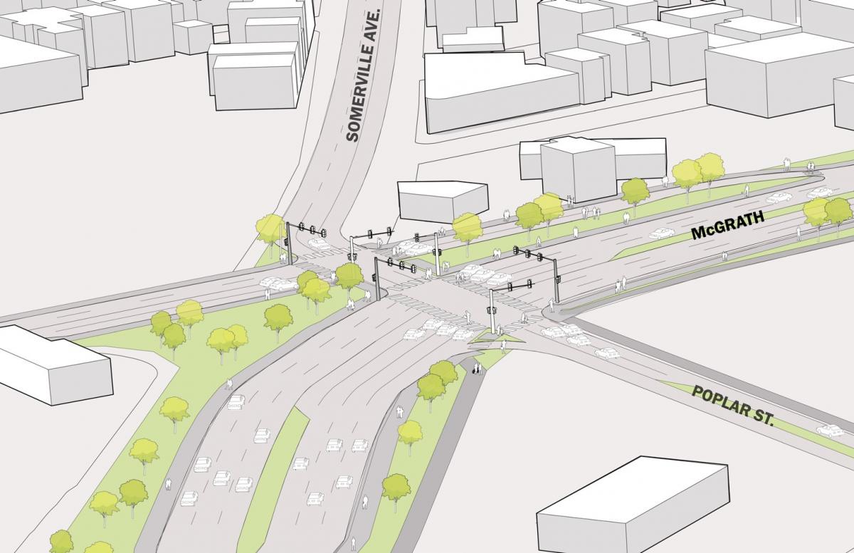
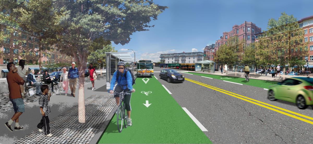
Traffic on the McGrath has decreased fifteen percent in the last decade and is expected to decline further with the extension of Massachusetts Bay Transit Authority’s (MBTA) Green Line and demographic trends showing reduced driving and car-ownership. Right now, current traffic counts on the elevated McGrath are comparable to the walkable, mixed-use Massachusetts Avenue. In addition, since the earlier Grounding McGrath study, the City of Somerville has further asserted itself as a desirable destination for tech-companies, green businesses and maker spaces. The expectations for a pedestrian and transit oriented place based boulevard is higher than ever. The LivableStreets Alliance continues to build its coalition of neighborhood groups, advocacy organizations and elected officials with the hope of reknitting East and West Somerville back together while opening up acres of land for pedestrian oriented development.
Top photos: Boston, 1938 and 2013. Source: The Institute for Quality Communities - University of Oklahoma
Similar Projects
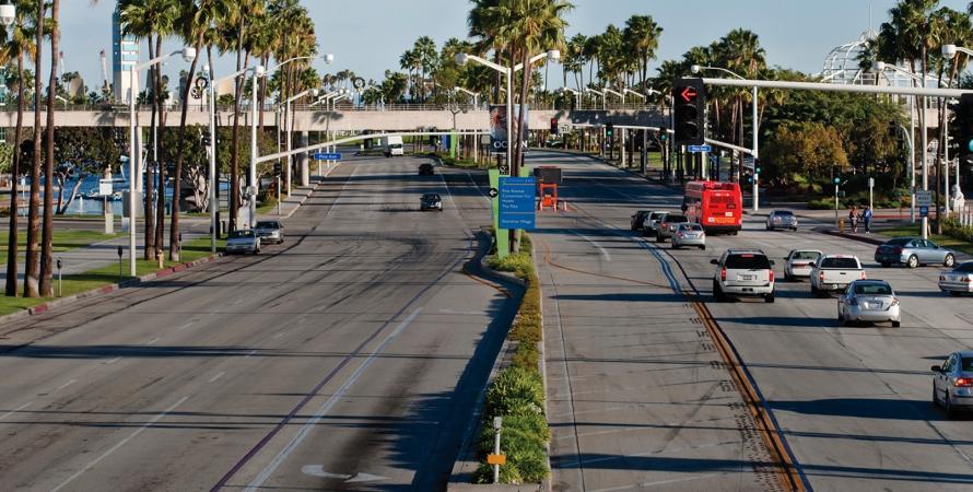
Shoreline Drive
Long Beach, California
Connecting the Interstate 710 Freeway via Shoemaker Bridge to Alamitos Avenue on the eastern edge of the Downtown, Shoreline Drive takes many different characters, reflecting its various eras of expansion.
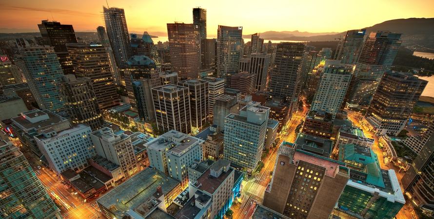
Georgia & Dunsmuir Viaducts
Vancouver, Canada
In 1915, the elevated freeway, the Georgia Viaduct, was built to circumvent the tidal waters, rail lines and industries below.
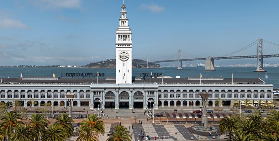
Embarcadero Freeway removal
San Francisco, California
San Francisco's Embarcadero Freeway was originally designed to connect the Bay Bridge and the Golden Gate Bridge but was never completed.