In the early 1950s, when construction began on Rochester's Inner Loop Highway, the city's population was about 330,000. Today, Rochester is a shrunken city of about 210,000, with 50,000 jobs in its downtown core (in a metropolitan area of over 1,000,000).
The 2.68-mile Inner Loop was built for a more populous city in an era of planning that was dominated by highway engineering and ample federal subsidy for single-use expressways. Like most beltways fully built out in the mid-20th century, the Inner Loop completely encircles Rochester's central business district. Many colorfully portray the circular Inner Loop as the noose around the city's neck. It is a major physical barrier between the downtown and nearby, densely populated neighborhoods. While central Rochester continues to experience somewhat of a rebirth, much of the urban fabric near the Inner Loop is encumbered by vacant and underutilized land.
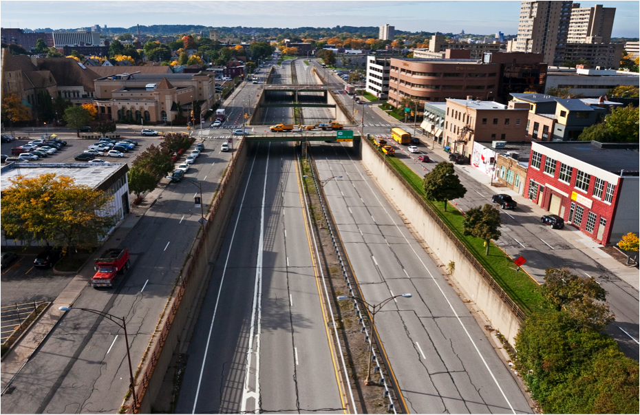
Part of the highway serves significant traffic volumes (up to 46,500 a day). Other segments carry a lot less. In particular, the eastern section carries only 10,500 cars/day, low enough to be handled by a modest urban avenue. This 2/3 mile stretch bordering the popular East End is known as the Inner Loop East and has been targeted for replacement with an at-grade boulevard.
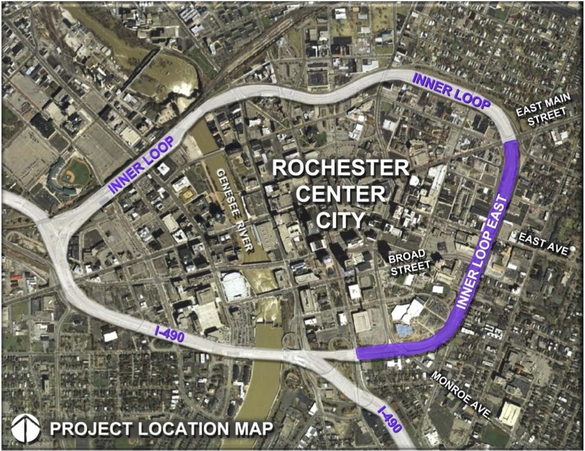
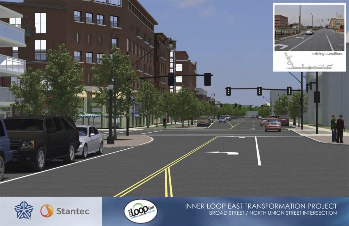
Boulevard conversion of this section was a major component of Rochester 2010: The Renaissance Plan, in 1999. This was followed by the 2001 Inner Loop Improvement Study. Finally in 2012, with the support of former Mayor Tom Richards and a critical mass of community support, the City was awarded a $17.7 million USDOT TIGER grant. The grant is facilitating the replacement of the Inner Loop East, bringing the highway between Monroe Avenue and Charlotte Street up to grade, and creating a two-lane complete boulevard with street parking and bicycle lanes on either side of the street. Securing this competitive grant is a major success for Rochester, and a positive precedent for freeway removal efforts around the U.S. The city has secured funding for the rest of the $23.6 million needed for the project by the Fall 2014 construction start date.
The agreement to remove a fraction of the Inner Loop is a victory for the city and removal advocates. It speaks volumes of the political will to advocate for a more livable Rochester. Newly elected Mayor Lovely A. Warren inherits a project that not only beautifies the city, but also has the potential to improve economically distressed areas. Nine acres of land will be freed for new development. This study estimates the freed land "could support 427, 913 to 795,062 square ft. of new mixed-use developments, valued between $8.0 million to $11.5 million" , while bringing in new property taxes for Monroe County, the City of Rochester, and local institutions.
Some of the most significant project developments over the past several months have included the reconstruction of East Ave into an at-grade street, which eliminated a bridge over the former Inner Loop. Additionally, Mayor Lovely A. Warren hosted Federal, State, Local Representatives at Inner Loop First Fill Ceremony in November of 2014. Charlotte St, which has been divided by the Inner Loop since 1964, has been reconstructed and now extends from Alexander Street to Scio Street. Broad Street has been reconstructed as an at-grade street, which eliminated a bridge over the former Inner Loop, and Savannah St has been extended across the former Inner loop connecting to the new South Union St. In order to encourage sustainable economic growth and create a more livable Downtown, Rochester is in the process of reconstructing a 2/3 mile stretch of the eastern segment of the Inner Loop between Monroe Ave and Charlotte St into a high quality complete city street. The new at-grade street will tremendously enhance the area's livability, allowing people to easily walk and bicycle between neighborhoods and Downtown.
All told, the rest of Inner Loop is still a barrier to the city's core and adjacent neighborhoods, cutting a 160 to 225-foot barrier between them, and remains a relic of an antiquated, auto-dominated period of U.S. planning. With the first step already underway with the removal of the Inner Loop East, the future hope is for the City of Rochester to remove the remainder of the Inner Loop.

The Inner Loop East being filled in, back up to grade. Photo credit: Stantec
Be sure to look at the City of Rochester's support page to get involved and stay current on this project's progress.
Keep up with the Live Webcam
Top photos: Rochester, 1951 and 2014. Source: The Institute for Quality Communities - University of Oklahoma
Similar Projects
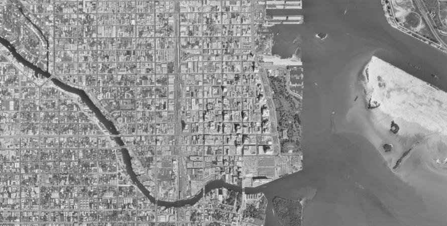
Overtown Expressway
Miami, Florida
Settled in the 1890’s before Miami was even incorporated, Overtown, originally "Colortown", is the historic heart of the city’s black community.
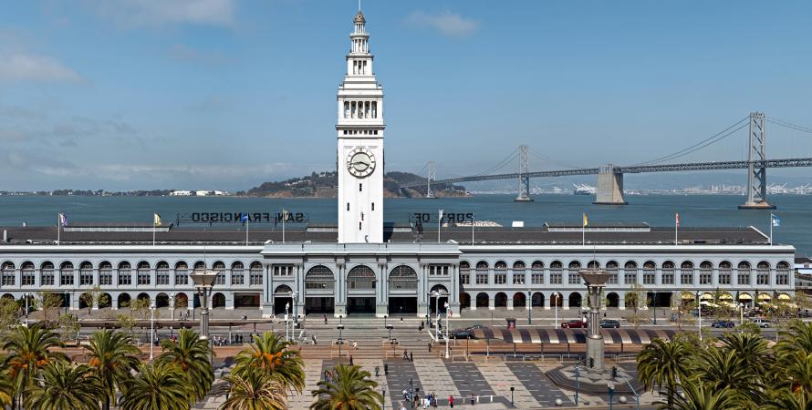
Embarcadero Freeway removal
San Francisco, California
San Francisco's Embarcadero Freeway was originally designed to connect the Bay Bridge and the Golden Gate Bridge but was never completed.