


History and Context
The DLSD is an eight-lane wide highway that runs 15.8 miles from Hollywood Avenue in the Edgewater neighborhood on Chicago’s North Side to 63rd Street in the Jackson Park neighborhood on the South Side. Initially, the road was intended for leisure drives through the new lakefront parks, in a right-of-way much narrower than exists today. “The Drive,” as it’s colloquially called in Chicago, runs parallel to the iconic Lake Michigan shoreline for its entire length, and mostly adjacent to or through the city’s many lakefront parks, including Lincoln Park, Grant Park, Burnham Park, and Jackson Park. The road was ultimately transformed into an expressway following the rise of widespread private automobile use starting in the early 20th century. It is widely viewed as a noisy, dangerous, and polluting barrier between the city and its greatest natural resource, geographic feature, and public space.
Proposal
The Illinois Department of Transportation (IDOT) is leading the Redefine the Drive planning project, which is a proposal to enlarge DLSD and rebuild it to interstate-grade expressway standards. The project is mired in accusations of ignoring community feedback and obfuscation. The process is widely and credibly understood as being designed to produce a predetermined proposal to rebuild the facility as a fully-fledged expressway. This is in spite of ongoing and growing community opposition.
Better Streets Chicago (BSC) laid the groundwork for the Save the Lakefront coalition to take shape and has actively led advocacy efforts since it was established, including extensive community outreach and coalition building efforts. These efforts enabled a coalition to take shape quickly following the 2024 announcement by IDOT and CDOT of a preferred design alternative. Individual community members, stakeholders, advocacy organizations, and elected officials have expressed deep concern about and outright opposition to keeping DuSable Lake Shore Drive an expressway as the proposal has few champions outside the state and city DOTs. BSC is presenting an alternative vision for transforming DLSD into a boulevard to reduce travel speeds, increase safety, encourage mode shift, prioritize transit, and improve conditions for pedestrians and cyclists. There is consensus that the corridor should be rebuilt accordingly.
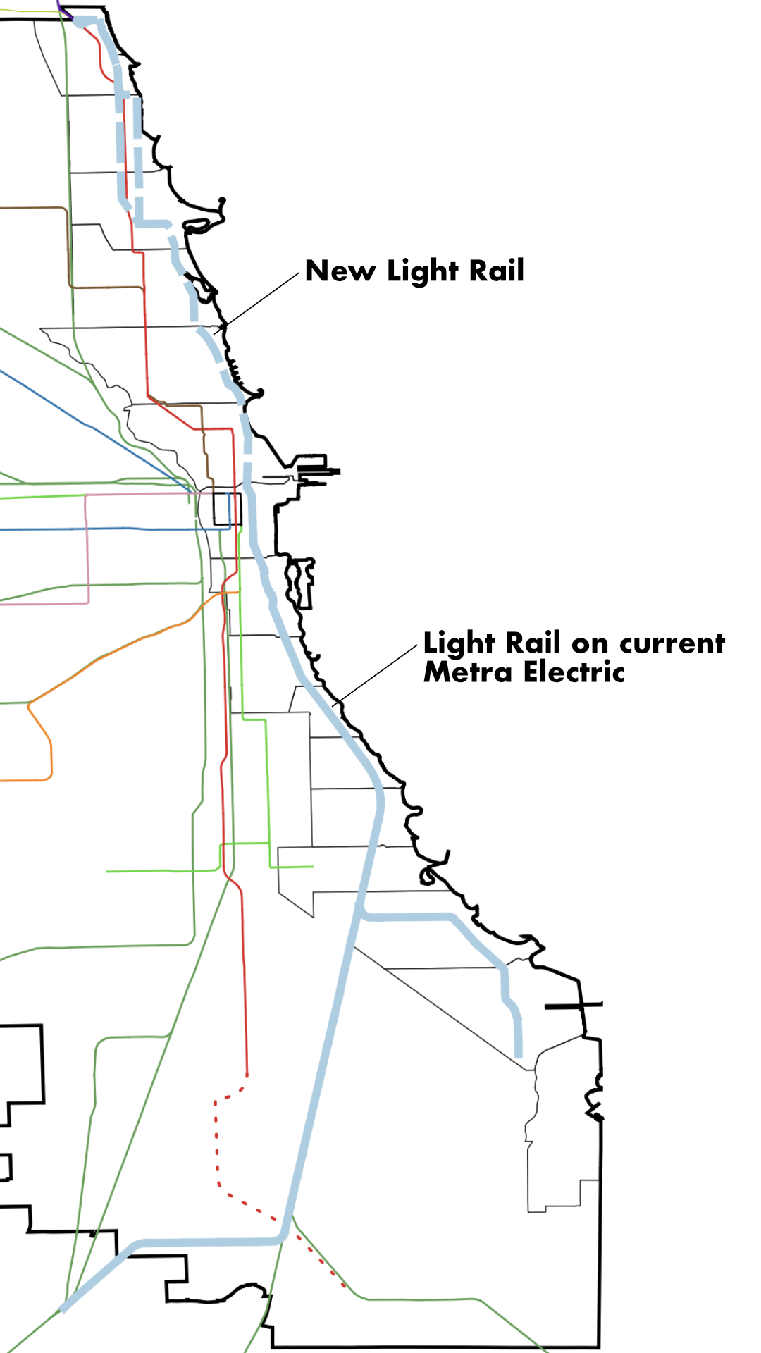
Current Plans
By removing grade separated junctions, retaining a mix of at-grade pedestrian crossing at junctions, and retaining a mix of over and underpasses, the design improves lakefront access. By reducing the overall footprint and vehicle lane widths, the design reduces speed and increases safety, especially for park users. Slower speeds and fewer vehicles would likewise reduce noise pollution and other forms of vehicle pollution. The reduced footprint could also enable the expansion of the lakefront parks by anywhere from several dozen to over 100 acres across the system. This would greatly improve the city’s ratio of parkland to residents, which is notoriously low.
Removal would greatly reduce congestion in Chicago, in particular in the downtown area and densely developed North Side neighborhoods, which are really struggling with congestion. It would also improve the city’s standing as a tourist destination, which is a rapidly growing industry in the city.
Furthermore, by not rebuilding DLSD as an expressway, the city and state could reduce project costs by a billion dollars or more, stretching overall public investment. Resident access to jobs centers on the North and South Side would be greatly improved; this is particularly the case for the South Side, which is about to receive significant investment in high tech industrial centers near the lakefront and Port of Chicago. A complete, independent economic impact analysis is currently underway to shed more light on the impact in this area.