History and Context
The 5-mile Innerbelt Freeway was proposed in the 1960s as a cure for Akron’s struggling downtown, connecting it to the growing suburbs on the city’s periphery. Reports at the time promised that the highway would spare “good” neighborhoods and clear “deteriorating” ones, like the predominately African American neighborhood West Hill.
The six-lane road was built in segments, with the first ¾ mile completed in 1973. The next phases stalled before completion, as state funding sources dried up and community opposition rose. By 1977, local reports blamed the highway for causing economic, social, and environmental harm to the region. Only four total miles of the highway were ever completed, failing to connect Route 8 to US Route 224, the original intent of the road.
Proposal
The downtown highway, originally built to handle 120,000 vehicles daily, carried approximately 18,000 vehicles daily by the mid-2000s and was plagued with an abnormally high crash rate. Given these conditions, civic leaders and citizen activists quickly realized the highway had become obsolete.
Today, the City of Akron is in the middle of a multi-year process to decommission the Innerbelt highway. In late 2014, former Akron Mayor Don Plusquellic proposed that the abandonment of Route 59 between West Exchange and West Market Streets, creating 30 acres near downtown that could be redeveloped with new housing, business districts, green space, trails, and civic buildings. The City received $5 million to decommission this portion of it. The final 0.9 miles of freeway, from the Dart Road exit and Rand Avenue entrance was closed soon afterwards.
Current Plans
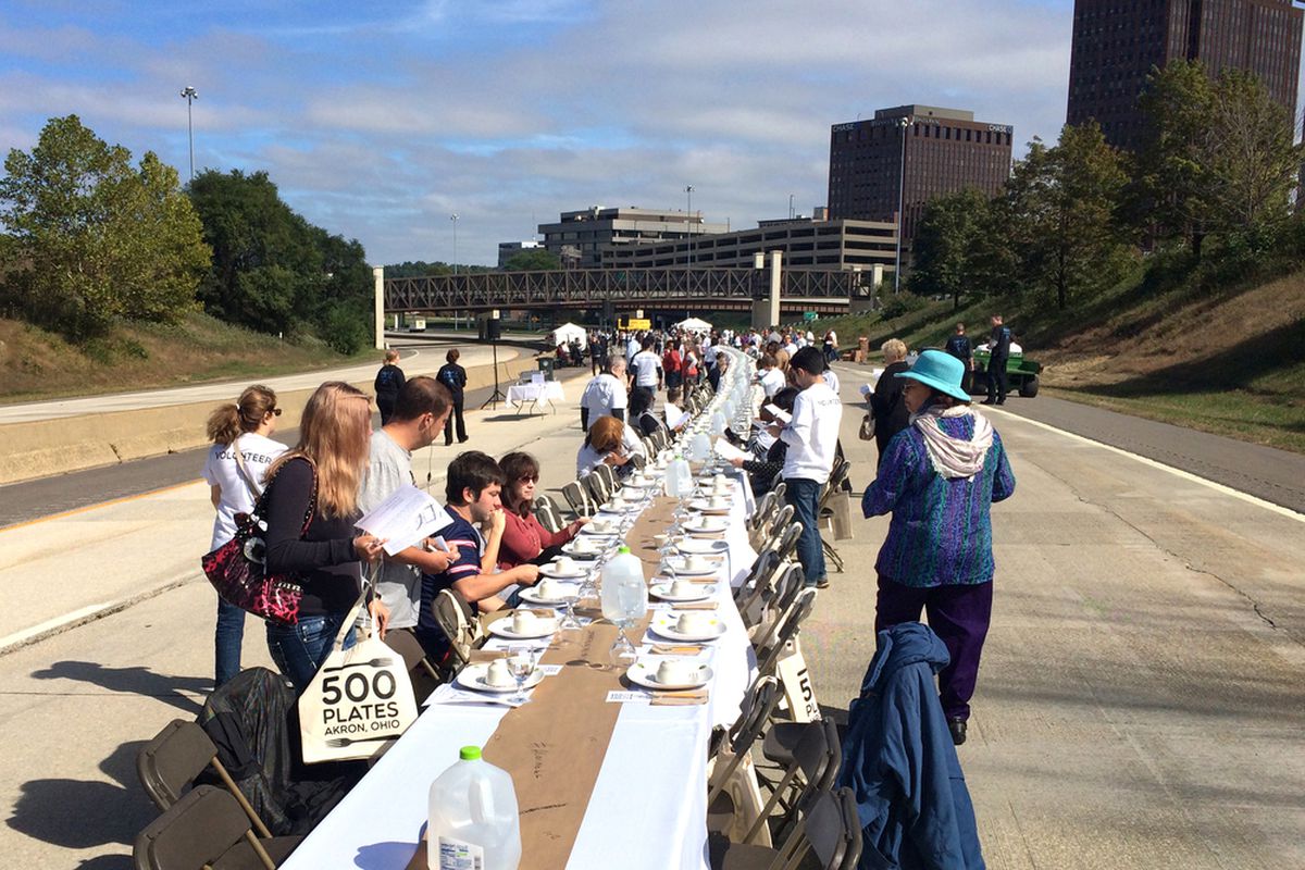
The City decommissioned the highway before deciding upon a final plan for the corridor’s redevelopment. This has allowed the City and its partners to thoroughly consider different options for the future of the right of way. With support from the Miami-based Knight Foundation, the City hosted a 500-person dinner on the decommissioned highway in 2015 to demonstrate how the piece of infrastructure could be reclaimed as public space. Since then, additional funding has supported other creative ideas such as the pop-up forest known as the Innerbelt National Forest.
In early 2017, the Ohio Department of Transportation started the removal of the Innerbelt Freeway. The removal has been named the Oak Park Renewal Project because it reconnects the historic Oak Park neighborhood to Downtown Akron. The removal is from Cedar Street to the Main Street/Howard Street intersection and after completion of the project, Dart and Rand Avenues will become the points of egress into and out of downtown Akron. The construction is still ongoing and future uses being considered for the restored space include potential redevelopment as a residential area with green space.