Parks and other enhancements proposed for city neighborhoods


A team of nationally recognized experts proposed catalytic interventions in the Eastside neighborhoods of Savannah, Georgia—a 2.5-square-mile area southeast of the city’s historic district.
Unlike downtown Savannah with its 22 famous squares, Eastside has little green space. The motor vehicles on Eastside streets move too fast for safety and pedestrian comfort. Eastside needs economic development, yet more housing is required to support shops and restaurants. Eastside is far less affluent than downtown and has seen minimal investment in recent decades.
Savannah as a whole needs more housing, especially for working- and middle-class residents, to accommodate a growing population—and that demand is likely to impact Eastside in years to come.
The design team looked at Eastside with a fresh set of eyes, offered new ideas, and “told me the things in a way I didn't think about before,” says Alderman Bill Durrence, who represents the area. “When you look at something for a long time, you are blind to a lot of it. Yet things are constantly changing. The real issue is how you manage the change for the benefit of the community.”
The Eastside project could have real impact. Recommendations from the event in early March were included in a proposed downtown plan called Savannah 2033. Public hearings for Savannah 2033, which has garnered interest from a majority of City Council members, are likely to begin in the summer.
The goal of the Eastside project is to “promote public and private partnership, increase housing, enhance neighborhoods, create safer walkable streets, build parks, and offer incentives to businesses that wish to locate or expand operations in the neighborhood,” says architect and urban designer Dhiru Thadani, who led the consultant team.
The vision was presented at the end of a "Legacy Project" of the Congress for the New Urbanism (CNU) in advance of its annual Congress, to be held in Savannah May 15-19. CNU and the city sponsored the project and consultants contributed time and resources. Legacy Projects are launched so that the Congress will leave an enduring mark on the host city and region.
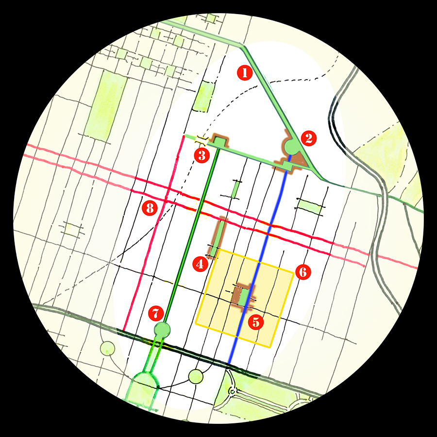
The four-day workshop included touring the site, meeting with local officials, city staff, residents, and stakeholders. The team proposed eight implementable recommendations, located by number in the plan above and detailed below:
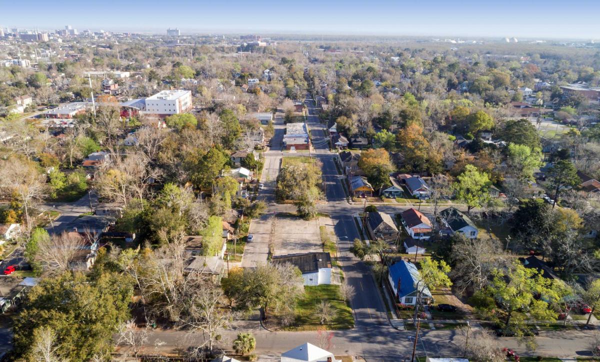
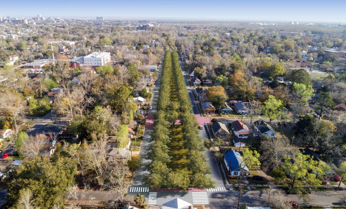
1. The tree-lined, lush streetscape of Liberty Street changes abruptly when it leaves the downtown core and becomes Wheaton Street in Eastside. The landscaped median should be extended to Wheaton Street to reduce the harsh transition when leaving the historic core.
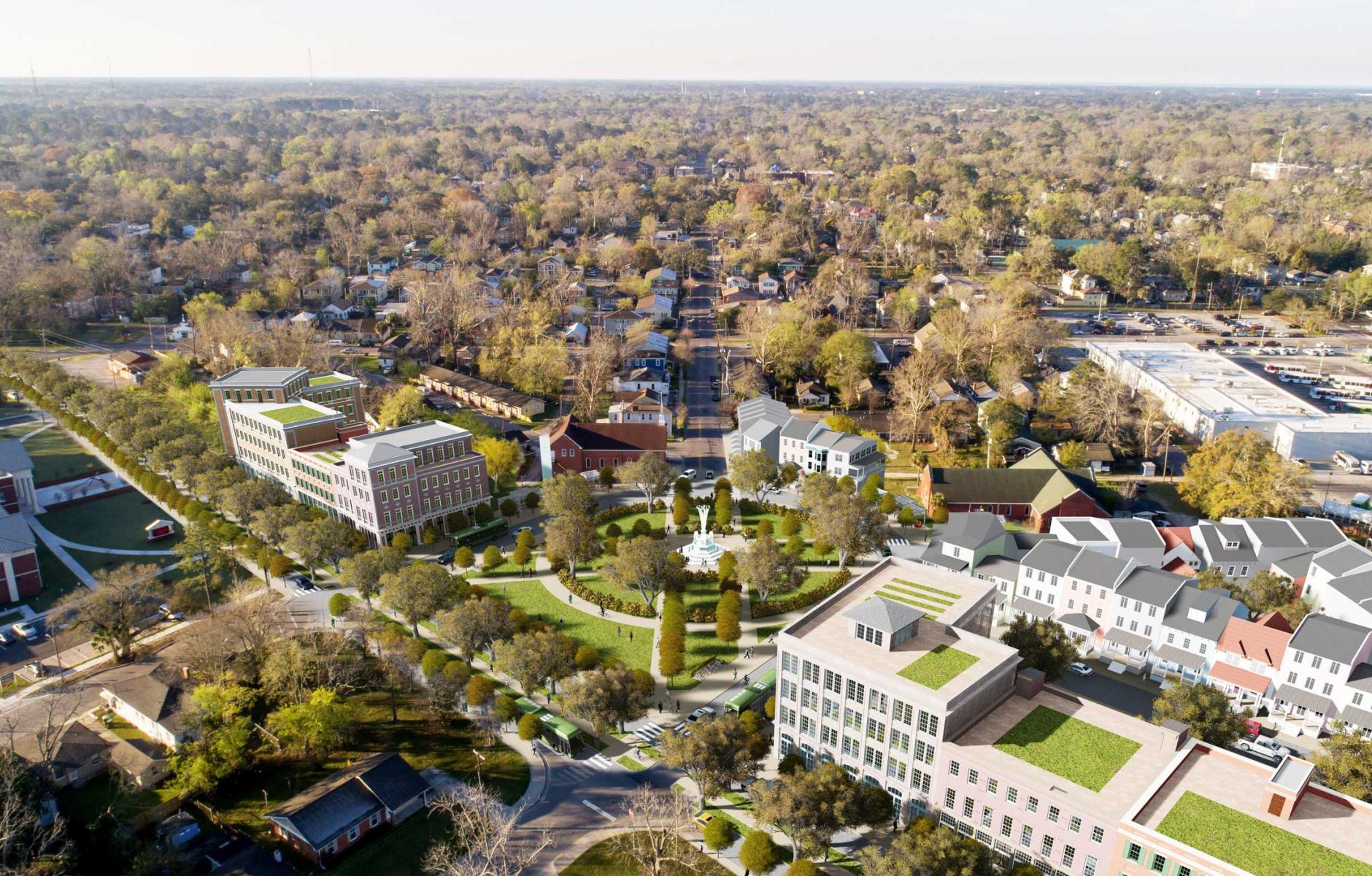
2. Create a “horseshoe” shaped park at the intersection of Wheaton Street and Waters Avenue, defined by mixed-use buildings (see image at top). The park would be large enough so that the two existing churches would have facades visible from the public space. The retail businesses would have exposure to the traffic on Wheaton Street, and be close enough to serve the neighborhood. Stakeholders expressed concern over potential loss of private parking, but Thadani pointed out that an equal amount of new on-street parking would surround the park.
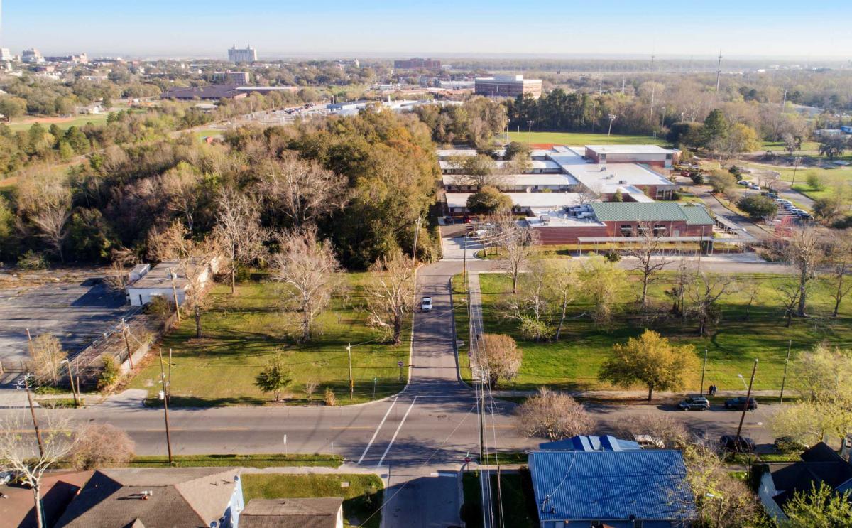
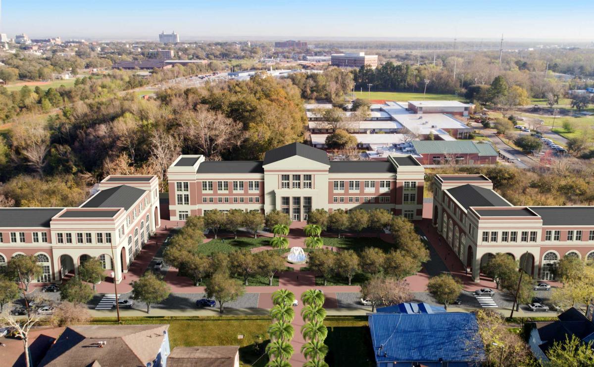
3. Create a new public park at the north end of Atlantic Street at Gwinnett Street (see before and after images above). The park would support public uses like a library and early childhood learning center that complement the adjacent Hubert Middle School. The public uses would programmatically respond to the local Purpose Built Community workgroup’s concepts for the area.
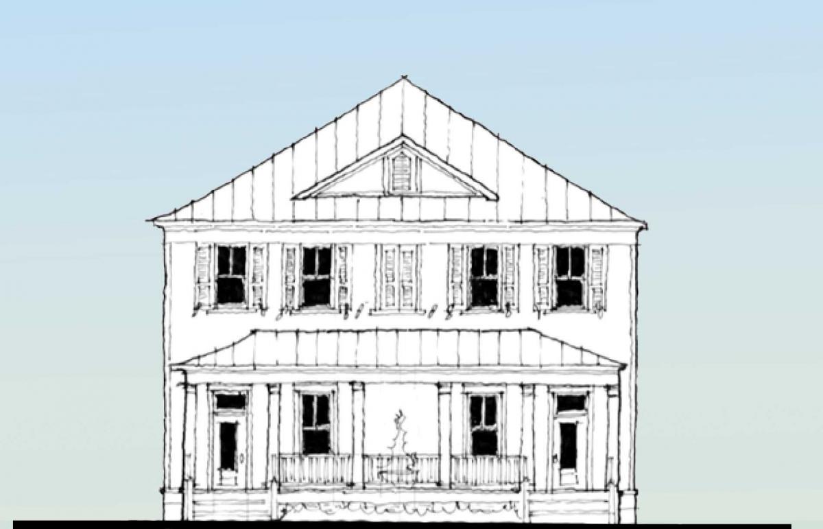
4. Return the use of four thin blocks between Vine Street and Paulsen Street, south of Henry Street, to a linear park (see before and after images above). Add elevated “pedestrian tables” to corner intersections of the linear park to control traffic speed and boost pedestrian safety.
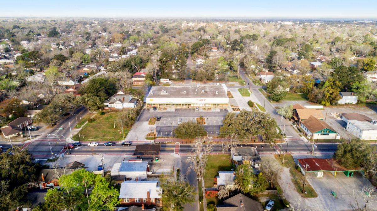
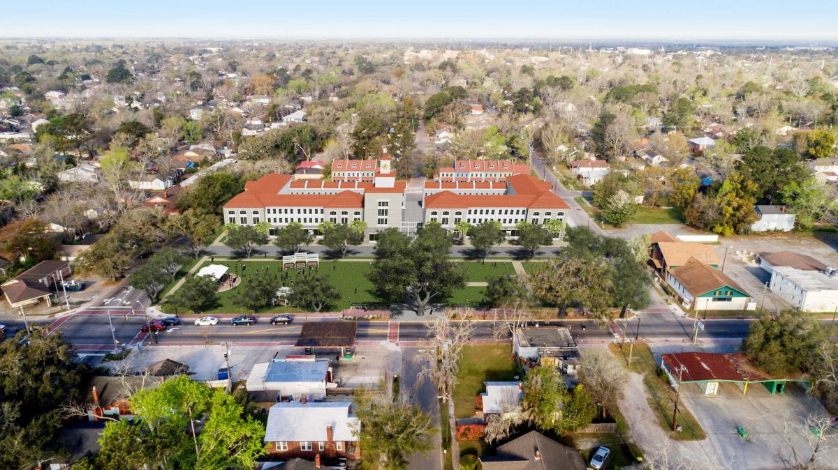
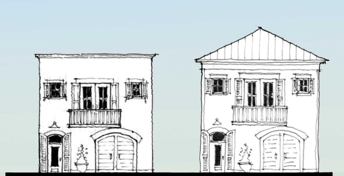
5. Develop an underutilized, City-owned commercial property on Waters Avenue at East 37th Street into a public park with a mixed-use, mixed-income residential and retail neighborhood center. This catalytic development would respond to the demand for rental housing—with on-street parking to support retail activity (see before and after images below).
6. a. In a multi-block area centered on the commercial property (recommendation 5) identify a “Lean” overlay zone where zoning and development standards are reduced, modified, or eliminated to facilitate small-scale re-development and new development. Parking, setbacks, and lot coverage standards are among those that could be reduced in the Lean zone without compromise of health, safety, or welfare. This Lean zone could be a test case that, if successful, may be expanded for use elsewhere in the City.
b. Within the overlay zone, provide a range of building type plans that are pre-approved and ready for construction. These units would range from small lane and carriage houses to small apartment buildings. This would encourage local property owners to build wealth-generating properties. The program would partner with local banks to provide pre-approved construction loans.
7. Atlantic Street has beautiful vegetation and a double row of palm trees around Victory Drive. Transform Atlantic Street by raising the elevation and making a pedestrian table for the entire one-mile length. Continue the double row of palm trees up to its termination at Gwinnett Street. The pedestrian table will serve to slow down east-west traffic that has a tendency to exceed the posted speed limit. Similar pedestrian speed tables are proposed for the intersections along Waters Avenue—at Anderson, Henry, and 37th Streets.
8. Convert Broad, Anderson, and Henry Streets to two-way traffic, from one-way traffic. This will slow traffic, make the streets more pedestrian-friendly, and raise property values.
To allay fears of displacement, the team was careful to propose interventions for underutilized land and buildings, Durrence noted. “They are using empty land. The plan doesn't take something that's already in use. It's redevelopment in a sense of finding uses for places that are not currently used.”
The Legacy Project team also included designers and consultants Bina Bhattacharyya, Eric Brown, Marc Gazda, Marques King, Kevin Klinkenberg, Andrew Krizman, Rahul Malla, Christopher Rodriquez, Laurie Volk, Christopher Volk-Zimmerman, and Hayley Spaulding.


