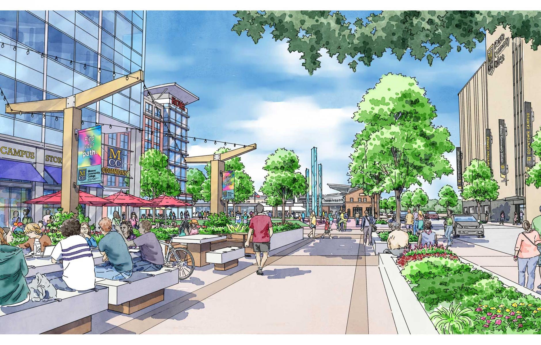
Why we need walkable density for cities to thrive


Leading new urbanists David Dixon, Laurie Volk, and Marina Khoury explain why, where, and how density can be used to revive cities. This new urbanist perspective on density is based on a powerful presentation at CNU 33 in Providence.
David Dixon: Why walkable density matters, and why now
For too long Americans have feared “density.” Yet, as the Urban Land Institute noted more than two decades ago, not all densities are born equal: “Density without amenity is crowding. Density with amenity is community.” The purest test for density? Does it promote walkability: “walkable density.” This insight captures the essence of a growing New Urbanist imperative:
Getting density right: when thoughtfully designed and strategically located walkable density represents an essential catalyst for enhancing economic vitality, environmental sustainability, and places that bring us together to celebrate shared community.
Today, the conversation around density is more urgent than ever. A convergence of transformation forces—economic shifts, demographic evolution, growing equity challenges, climate and public health crises, and a mobility revolution—is reshaping how we live, work, and move:
- As cities compete globally for talent in an increasingly dominant idea economy that faces a growing workforce shortage, investment and jobs follow talent to vibrant, walkable, mixed-use places—supported by sufficient density. Compact communities that offer walkable, amenitized density are building an economic future for themselves and their regions—and in the process creating better economic futures for the workers across the skills and education spectrum.
- Demographics are unlocking the ability to get density right. Over the next 20 years, 70- 80 percent of net new households will be singles and couples—many seeking multifamily, higher-density living in mixed-use, walkable, urban places. Yet, 62 percent of US housing stock remains single-family detached, underscoring an historic mismatch and a massive urban opportunity.
- Growing denser New Urbanist neighborhoods is essential to addressing growing environmental and health crises—walkable urban places generate one quarter to one-half the emissions generated by their auto-dependent suburban neighbors and support significantly better public health data and longer lifespans.
- Meanwhile, the mobility revolution—driven by connected and autonomous vehicles—is poised to reshape our communities. Shared autonomous mobility will be the norm by 2040 in denser urban environments that provide a critical mass of riders and destinations—reducing parking needs (and the expense of structured parking), lowering mobility costs—and incentivizing compact growth.
Walkable density is no longer a niche concept. It is essential to managing these forces to achieve New Urbanist goals.
What density levels empower us to manage transformational change? One key measure of “walkable density” provides a sense of scale: roughly 1,000 new housing units within a five-minute walk can bring a block of “Main Street” to life, support transit systems like Bus Rapid Transit and Light Rail, and promote the “creative collisions” that fuel our idea economy.
The path forward is clear: shape density to the task at hand, locate it where it can make a difference, and harness public-private partnerships to unlock its full potential.
Density, done right, is not about buildings—it’s about building better lives.
Laurie Volk: Putting density to work—a tale of two cities
In 2010, Providence, Rhode Island, and Jackson, Mississippi, had roughly the same number of residents—both topping 170,000—and shared distinctive similarities: both are state capitals; host noted universities, museums, and hospitals; grew up along rivers; and today sit at the intersection of major highways.
However, Jackson occupies more than five times the land area of Providence—113.2 square miles compared to just 20.5 square miles in Providence. In 2010, Providence had a population density of 8,600 persons per square mile compared to 1,530 persons per square mile in Jackson.
Between 2010 and 2025, just under 2,500 new dwelling units were built in Jackson, while nearly 3,100 were built in Providence. Most of the new housing was spread out across the Jackson but was concentrated in a much smaller area in Providence, creating the critical mass that enhances walkability and supports retail. Between 2010 and 2025, despite the new construction, Jackson lost 4,500 households. Over the same time frame, Providence gained 8,400 households.
By 2025, then, the population density in Providence rose to 9,400 persons per square mile, and the population density in Jackson fell to 1,240 persons per square mile.
As of this year, half of all occupied housing units in Jackson were rented, compared to over 60 percent in Providence. The greater density in Providence results in part from a significantly lower percentage of single-family detached units—just a quarter of all dwelling units compared to Jackson, where over two-thirds of all units are single-family detached.
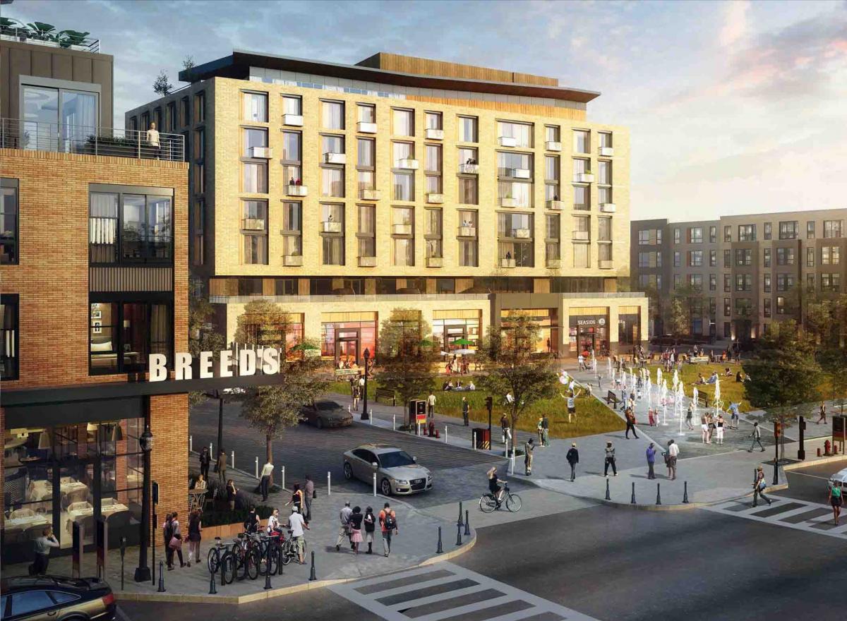
And the key to higher densities in Providence is high-rise units, but a concentration of “missing-middle” housing types, including small multi-family buildings, duplexes, townhouses, and rowhouses, that make up 59 percent of Providence’s housing stock. Those housing types represent just 26 percent of all housing units in Jackson.

Because of its high densities, in addition to a thriving downtown, known as DownCity, Providence is home to numerous walkable residential and commercial areas in all areas of the city, including both housing and retail along Thayer Street, Wickenden Street, Westminster Street, Hope Street, and West Broadway, as well as in the Federal Hill and Wayland Square neighborhoods. Jackson, does have one area with similar residential and commercial densities—the Fondren neighborhood, about three miles north of Downtown, known for its music and visual arts, boutiques, and multiple restaurants—notably it benefits from a density comparable to Providence.
Marina Khoury: Our job is doing density right
When planners and citizens talk about density, they often talk past each other. Is it people per square mile? Dwelling units per acre? Transit riders per stop? The truth is, density has multiple definitions, and those differences matter. Gross density, for instance, counts units against the total site area, but it hides key variables like wetlands or open space. Net density is more accurate, measuring only the urbanized land and offers perhaps the clearest measure across projects.
Still, none of these alone explains what a neighborhood will feel like. Because life is not lived in statistics.
We live our lives in the rhythm of streets, the texture of facades, the scale of courtyards, and the everyday experiences of walking from one place to another. The same unit count can yield a lifeless subdivision or a beloved compact neighborhood, depending on design choices about building types, parking, and public space. Density, in other words, is the frame. Our job is to draw the picture.
Market forces complicate this picture. Developers chase predictable returns, lenders demand double-digit yields, and cities juggle the fiscal math of infrastructure maintenance. A compact block of townhouses may outperform sprawling subdivisions, but financing systems still tilt toward single-family homes. Retailers, schools, and transit providers each impose their own thresholds, calibrated to their needs. Meanwhile, even when citizens clamor for affordability or walkability, fears about traffic, parking, or neighborhood change can stall reform. We need to work together to plan to get density right.
And examples abound. Historic Charleston thrives at 27 units per acre, proof that beauty and compactness can coexist. Kentlands thrives at 7 units per acre net, 14 net-net (including only building sites), achieving a balance of diversity, affordability, and fiscal resilience. Careful combinations of missing middle housing using strategies such as internalized parking and design that respects neighborhood context, show how thoughtful planning can overcome opposition and produce successful and enduring places.
The challenge today is to translate these lessons into policy and practice. Some governments are acting boldly. Britain is setting minimum density standards, Texas is prohibiting oversized single-family lots in certain markets, and Florida is incentivizing higher densities for affordable housing, by right. These moves are controversial, but they acknowledge a hard truth: land is finite, infrastructure costly, and the stakes for livability high.
If we start with the right questions, not “how dense?” but “what kind of place are we building?”, we can craft communities that are walkable, diverse, resilient, and fiscally sound. Density done right is not just a number. It is the art of shaping places that endure, made meaningful for the generations that follow.