Bicycle-oriented development, a promising regional growth strategy


In Bentonville, Arkansas, I recently witnessed bicycle-oriented development (BOD) in action. The Razorback Greenway is a 40-mile multi-use trail, mostly completed in 2015, that connects all of the major cities in the region.
At first, the Greenway was just a recreational trail. Then it morphed into an active transportation system. It is now being planned as a spine to organize regional growth over the coming quarter-century. This sounds like a great concept, so when I spend a week in Northwest Arkansas (NWA) for CNU 34, I wanted to see for myself whether this is a realistic idea.
So, I took a walk on the trail from my hotel in downtown Bentonville. The Greenway goes through the heart of Bentonville, as it does in Springdale and Fayetteville to the south. The Greenway also goes through Rogers, the other major NWA city, but not through its downtown. However, Rogers has built a bikeway linking downtown to the Greenway.
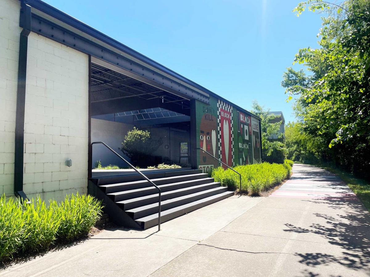
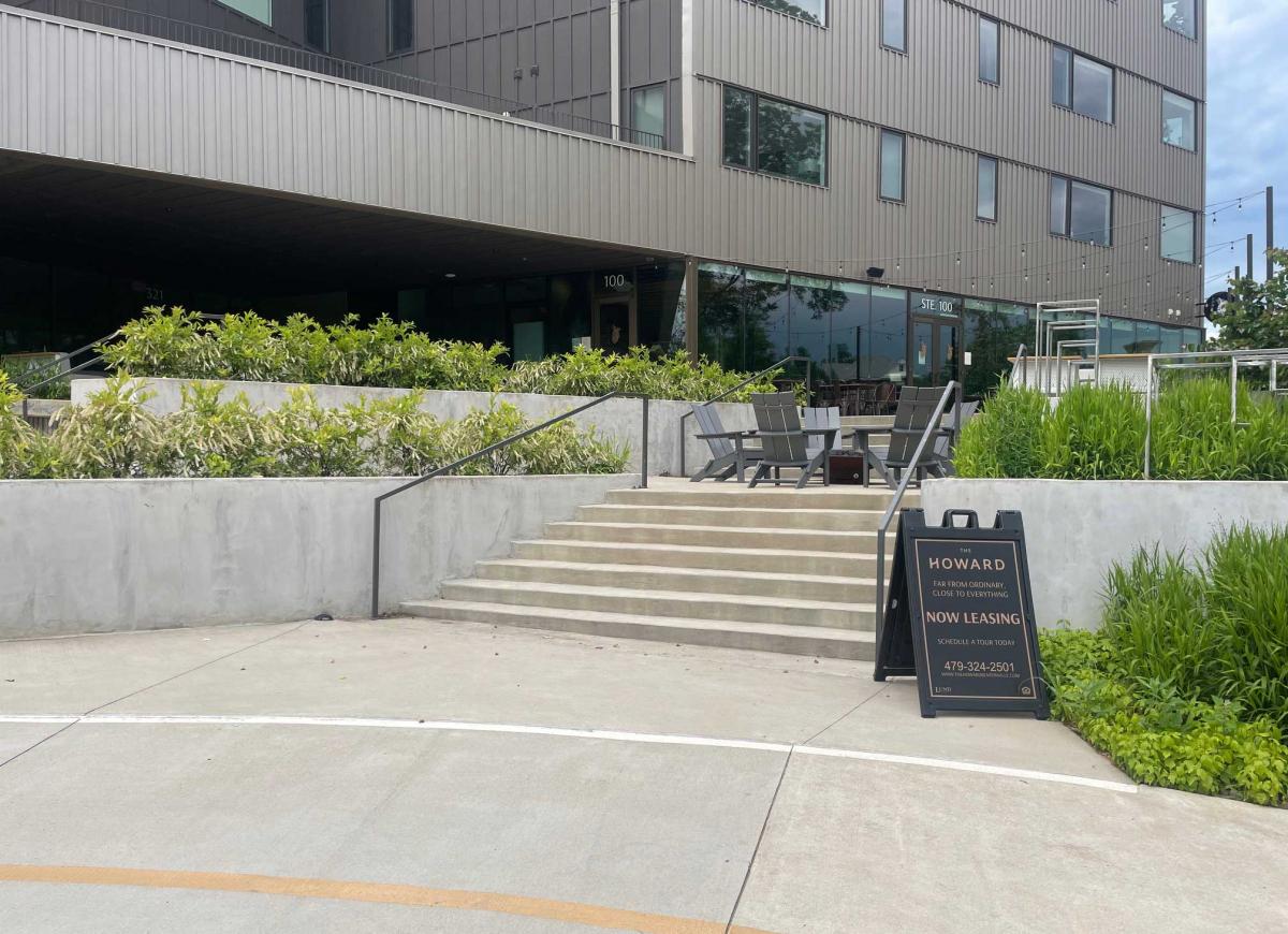
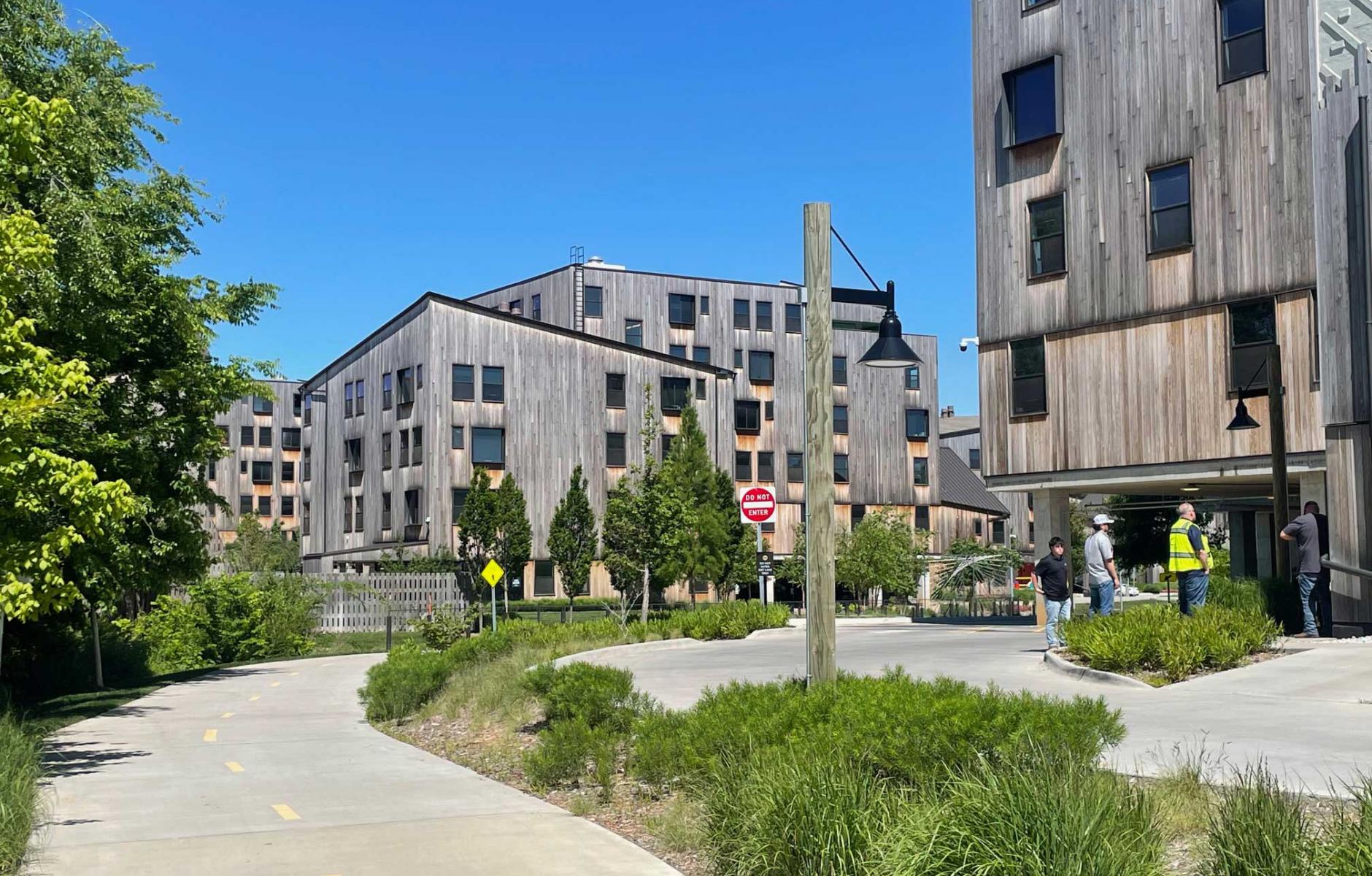
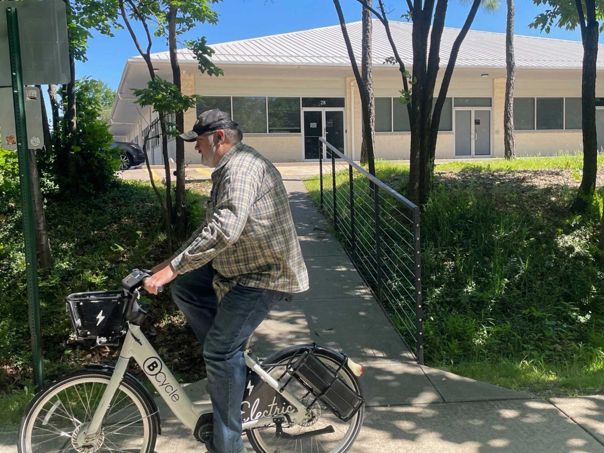
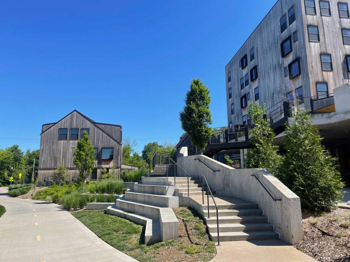
This is what I found on my walk: Apartment buildings and complexes, office buildings, commercial districts, and old warehouses that have made modifications to actively front the Greenway. Some buildings that didn’t front the Greenway built back decks and patios to enjoy the Greenway. I walked from downtown Bentonville to the new Walmart Home Office, where the campus was designed around the Greenway. The Greenway runs through the heart of the campus, creating a major public space shared by the community.
I didn’t have to look hard to find that the Greenway is shaping development along its path—the signs were everywhere. Land uses that previously had no connection to one another are now linked by the Greenway. Buildings that previously fronted a parking lot or an automobile-oriented street now also connect to a bike-ped trail. These connections often take the form of stairs or walkways. The new Home Office is a bigger leap: The world’s largest corporation has built its headquarters around the Greenway. The Walmart Home Office explores how to do BOD connected to a campus.
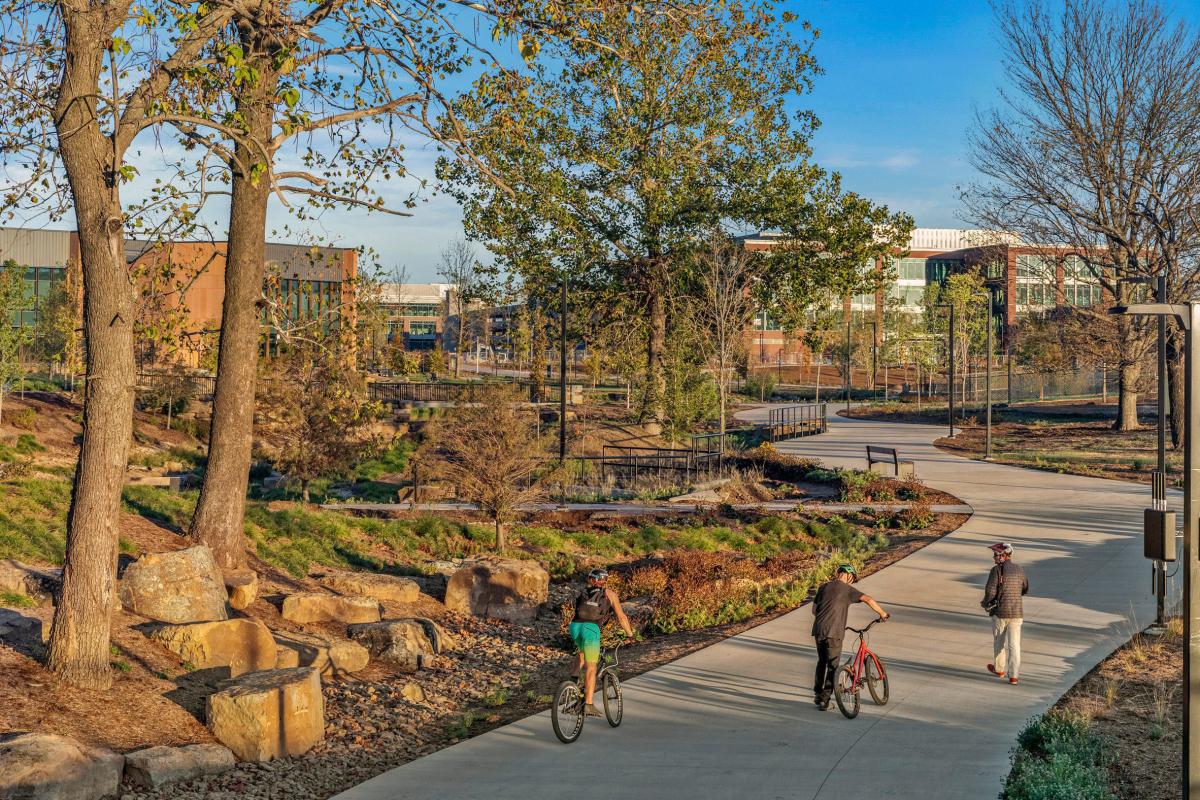
A plan that was developed by the Northwest Arkansas Regional Planning Commission has even higher ambitions. The plan uses the Transect to envision a matrix of ways in which multiple building types across a range of urban places could directly face the Greenway. The Greenway becomes an important thoroughfare for the region—albeit one that is 10 feet wide and geared toward bike-ped activity. The goal is that most new development in this fast-growing region—NWA is expected to nearly double in population by 2050—would have pedestrian or bicycle access to the Greenway.
The idea goes beyond building frontages to envision planned new neighborhoods and urban centers. In Phase 2 of the Razorback Greenway Plan, the Regional Planning Commission hopes to advance policies and design vision for key places along the trail. The key projects are inspiring because they show how compact development areas with access to the trail, from villages to walkable neighborhoods to urban centers, could accommodate much of the region’s growth.
The Razorback Greenway network was brought to life through a confluence of funding, collaboration, political will, and staff expertise. Corridor planning can evolve a successful trail into a broader mobility and land-use framework. The regional trail network can catalyze economic development, placemaking, and multimodal connectivity. At CNU 34, discussions centered on the Greenway and similar trails in other cities, like the Cross Charlotte Trail, Fall Line Trail in Richmond, Virginia, and the Indianapolis Cultural Trail.
The vision plan for the Fall Line, a 43-mile multi-use trail corridor under construction across the region, lists six benefits:
Community building. Creating places for people to meet and develop the relationships between people and place.
Economic development. Providing jobs that can be accessed through active modes with potential for increasing property taxes.
Healthy lifestyles. Supporting daily opportunities for exercising through close proximity to a recreational and active transportation corridor.
Active transportation. Encouraging walking, bicycling, and rolling trips and playing a role in supporting car-free living.
Sense of security. Increasing the eyes on the trail can make trail users more comfortable.
Resilient infrastructure. Establishing development that is sustainable, adaptive, and can respond to local needs and desires.
Regional trail spines can catalyze BOD, connect existing and new centers, and promote multimodal planning. The spines facilitate connections to new trails. In Indianapolis, the Cultural Trail has spurred an estimated billion dollars in new development over the last 7 years, it was reported at CNU 34.
The Atlanta Beltline, a 22-mile trail encircling the core of the city, was the first major regional trail system to gain national attention. The Beltline, it should be noted, was originally conceived as a way to organize the City’s growth, and it has succeeded beyond anyone’s imagination. It has resulted in $10 billion in development along it, a 12-fold return on investment—a figure also reported at CNU 34.
Planners thought deeply about how the Beltline could revitalize existing neighborhoods and create new ones. Planners envisioned new street grids, which have been built over the last 15 years.
The Razorback Greenway has contributed to a regional bicycling economy that tops $200 million a year, plus health benefits. If this Transect-based planning around the Greenway is successful, it could become the new model for BOD influencing regional growth in many cities coast to coast.
BOD, also known as trail-oriented development (probably more accurate because these are multi-use trails), is a major national planning trend, proven by the Beltline, the Razorback Greenway, and similar efforts. Bentonville is one of the best cities in the US to study its impacts today.