Street plans are ‘the foundation of city planning’


The greatest plans of the New World were all street plans—Savannah, Washington DC, Manhattan, and Philadelphia. They had no codes for a long time, and yet they endure today as great cities. Frederick Law Olmsted Jr., the great landscape architect, put it simply: "The street plan [is] the foundation of all city planning."
Up until about 100 years ago, when cities and towns were formed or expanded, they projected streets with small, walkable blocks, platted in parcels suitable for development. This was often done over private land, where landowners were compensated for the public right-of-way (ROW)—but they were also penalized if they built in the ROW, according to urban planner David Green.
In the last century, the idea of “taking” has superseded the idea of streets as a public good—and street plans have all but disappeared from modern planning, reports Green, a principal of Arup in New York City, in a recent CNU On the Park Bench webinar on Master Street Plans.
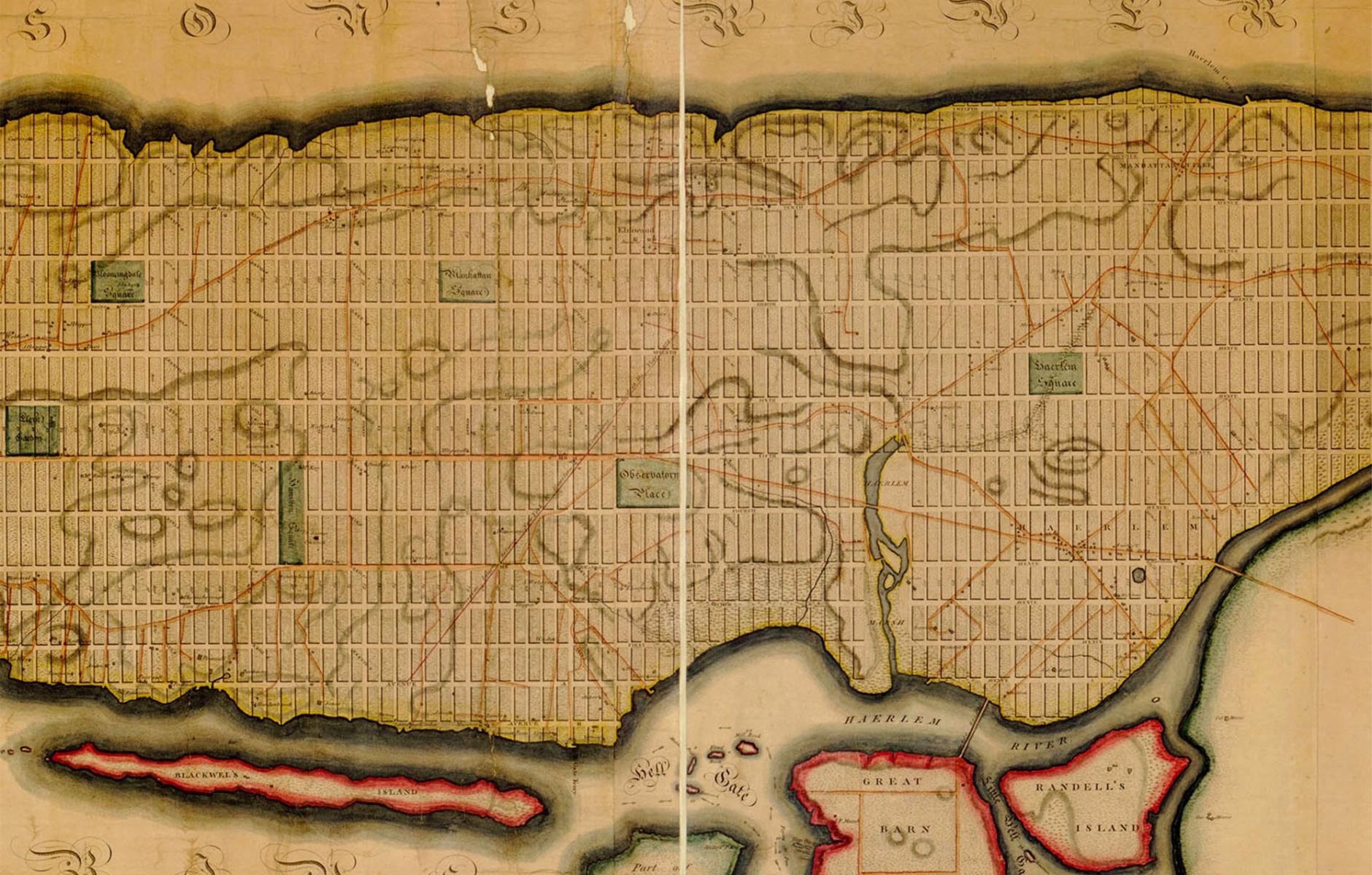
Streets are the most permanent part of cities. They can last for 2,000 years or longer. The 1811 Commissioners’ Plan for Manhattan set the city’s course for the last two centuries. It took 150 years to build out the frontage created by that plan, which generated enormous public and private wealth. The commissioners could not have envisioned what would be built on Manhattan’s streets and how the uses would change over the last two centuries. “How we divide up the land is more important than what we do with it,” Green argues. That method was how every planned city was built for most of the last 4,000 years, and cities grew organically and incrementally on the framework of human-scale streets, he notes.
The streets and property lines tend to last for millennia—they are the most permanent aspects of cities, according to Paul Knight, a senior planning associate at Historical Concepts. By contrast, private property uses change all the time. With the advent of zoning 100 years ago, cities prioritized the regulation of land uses, and based street design on those uses. “We are basing the most permanent parts of the city [streets] on the most impermanent parts of the city [uses],” Green explains.
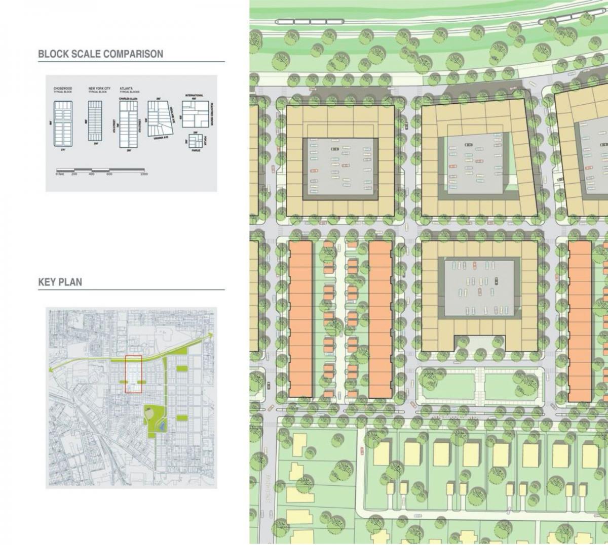
This had immediate negative effects. After 1928, blocks, which had been small and relatively uniform in cities across the US, became much larger and less uniform. “That was because the blocks were organized around land use, and whatever the land use, you had to have circulation requirements,” parking, and other regulations, Green explains. Small blocks are essential for walkable urbanism. As blocks grew larger, the streets became wider. All of this meant people had to drive everywhere, which required more parking, which in turn made blocks even larger—a vicious cycle.
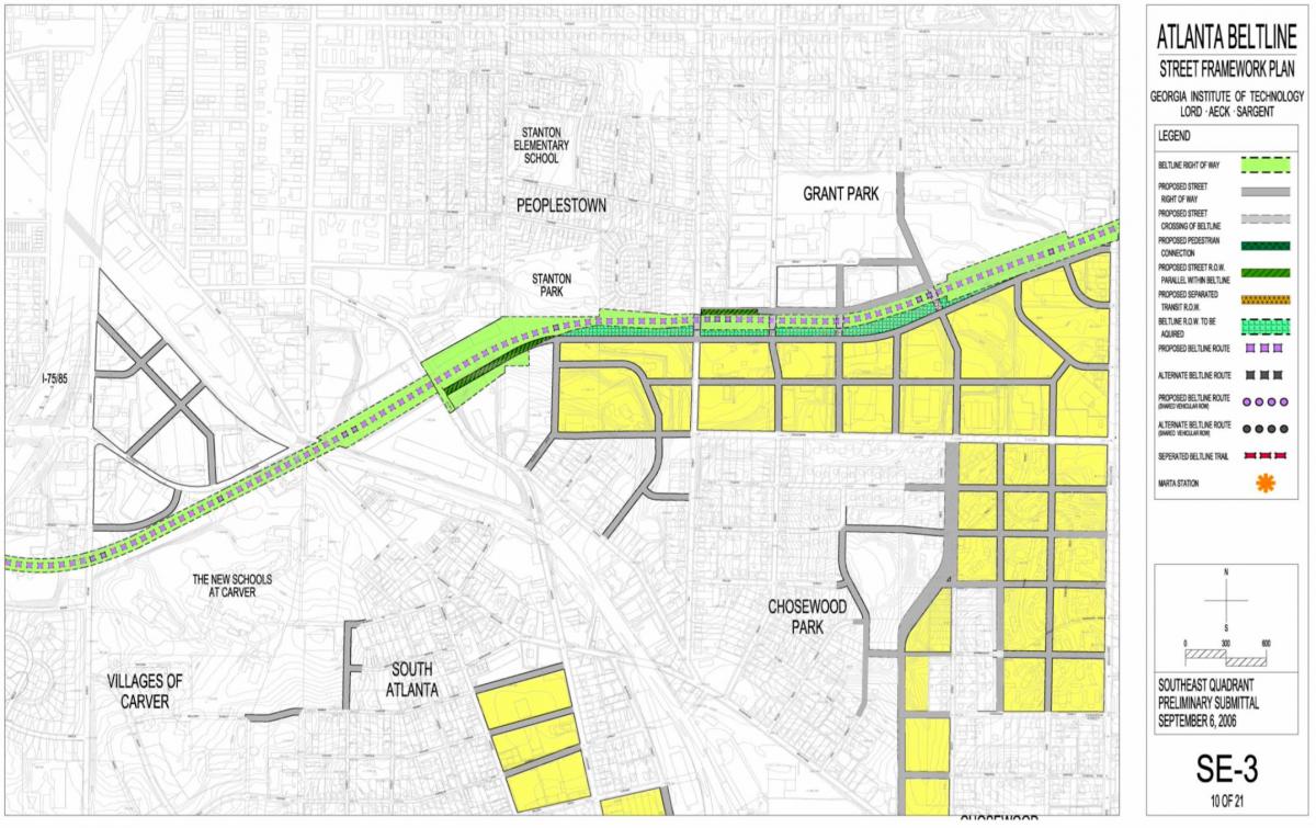
Green presented planning projects he has been involved in, where the street plan came first. One was planning for the 22-mile-long Atlanta Beltline in 2006, a trail on a former rail line that loops around the city. The planning examined land use on 6,500 acres adjacent to the Beltline.
We convinced the city to adopt a street plan, Green says. “We got everybody to understand that the most important thing was simply laying out the block structure,” he explains. In doing so, Green analyzed existing property lines to project the streets onto those lines, so that setbacks could protect the rights-of-way from development. Also, Green’s team pre-tested the block structure to ensure it could accommodate a large variety of potential uses and building types.
“I left Atlanta in 2014, and I came back 10 years later, and I thought none of this would have happened, but a bunch of these streets have actually been put in place,” he says. They were built despite claims that this approach is illegal. “That was what we were up against. It turns out it is not really illegal. There are ways to do this, but it is something we are told over and over again [that it is illegal].” The Beltline plan shows the power of putting those streets on paper in a legally adopted plan.
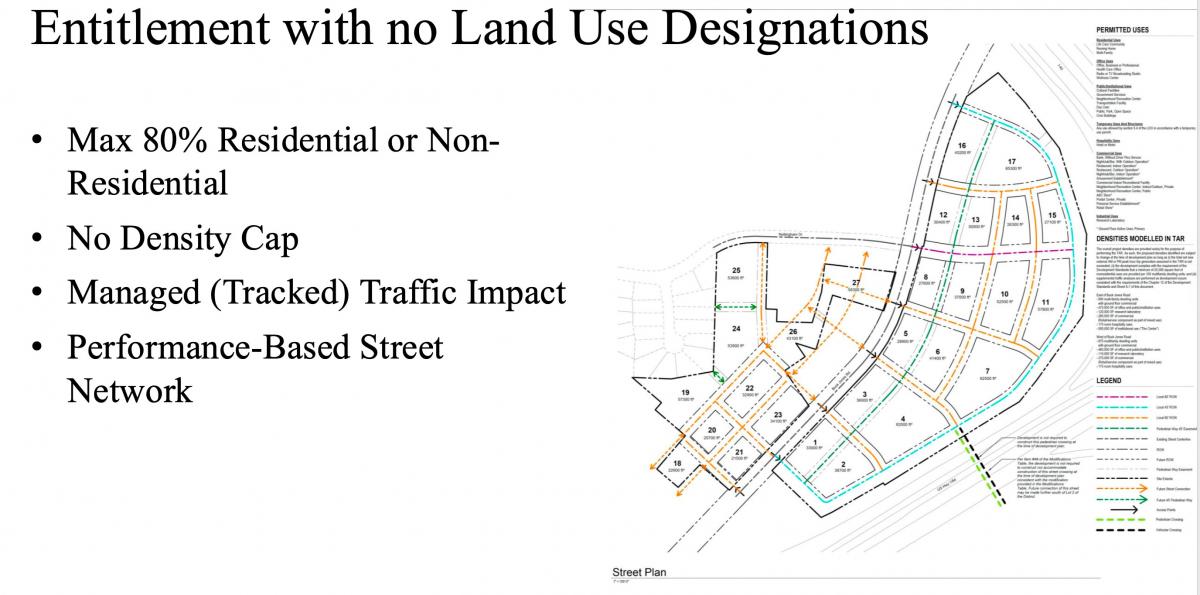
Green also presented a project in Cary, North Carolina, where a street plan was established for a commercial strip area adjacent to the interchange of two Interstate highways. He describes the South Hills District Development Standards as “nothing more than projecting streets. There is no density cap. The only use requirement is that there would be no more than 80 percent nonresidential or residential.”
On a much larger scale, a plan was developed for Kuwait, encouraging the national government to establish a 100-meter-by-100-meter grid. “It set in place a series of survey lines that become public rights of way. What it does is incentivize people to build more highly connected street networks.”
These examples prove that planning based on a master street plan is still possible on infill (Atlanta, GA), suburban retrofit (Cary, NC), and greenfield (Kuwait), locations. But Green notes that this approach remains unusual. There are legal, conventional, and professional hurdles to overcome in “a profession that is trying to maintain the current status quo,” Green says. “We are fighting against all of these things. And maybe in the next 20 years, we will start to look at street plans as the primary way we can plan these things in cities.”
The City Planning Enabling Act of 1928, created by Herbert Hoover’s Department of Commerce, had the right idea, explains Knight. The act prioritized the creation of street and public infrastructure—zoning private land was a secondary consideration. But that was later superseded by some bad case law, Green explains.
“Comprehensive Plans today are by and large worthless,” Green says. “The original comprehensive plan was the City Planning Enabling Act, and that tells you exactly what to do. When we are doing a 10-year plan, we shouldn’t be just saying this should be residential, and this should be commercial; we should be laying out the street network.”

Green closed with a photo looking down East Broadway in New York City, encapsulating the richness and diversity of Manhattan. What it shows is how the 25-foot by 100-foot parcels were developed, each “with no regard for style or use distribution. Making use of each parcel on an incremental basis. The kind of richness and variety that can come from simply laying out a street plan. This can never happen if it was a use-generated project.”
Watch the whole video:
