Study calls for land use changes to improve road safety


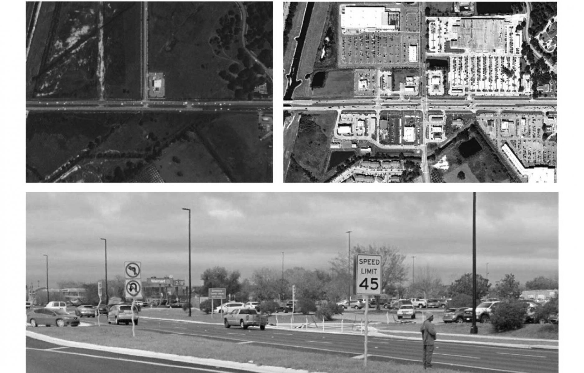
New research from Florida Atlantic and Columbia universities examines why the US has failed to make streets safer for “vulnerable users”—people outside of cars, especially pedestrians and bicyclists. That failure is evident despite the proliferation of Complete Streets and Vision Zero policies over the last 20 years.
The total number of US traffic deaths has remained fairly constant throughout this century—about 40,000 per year—while the subset of pedestrians and bicyclists killed has increased by 68 percent. Most are killed on urban arterials, of which there are 178,000 miles in the US. The US has failed to make a dent in the problem, even though European nations have successfully reduced fatal crashes for both vulnerable users and drivers using similar policies to Vision Zero, the authors note. The study by researchers Eric Dumbaugh and Jonathan Stiles examines hundreds of miles of arterial roads in Florida to find answers.
One explanation is the automobile-oriented design of urban arterials. “While it may not be necessary to redesign the entirety of this system, the redesign of even a small fraction of it is a major enterprise, one that would require a dramatic reallocation of capital resources and fundamental realignment of political will,” they explain. The other approach they recommend is to reconsider land use, as indicated by the study title, “Land Use and Road Safety: Understanding the Persistence of Vulnerable Road User Deaths and Injuries in the United States.”
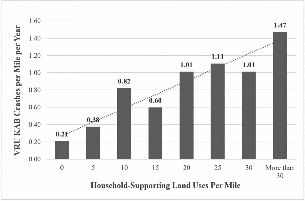
The development of “suburban patterns,” i.e. sprawl, since 1950, has meant that most grocery, pharmacy, and restaurant chains (especially fast food) seek locations on arterials with at least 20,000 cars per day. The research correlates the location of these businesses with high levels of fatal and injury crashes involving vulnerable street users. Dumbaugh and Stiles dub these businesses “household-supporting retail and commercial uses.” These types of businesses attract pedestrians and bicyclists to unsafe intersections and corridors.
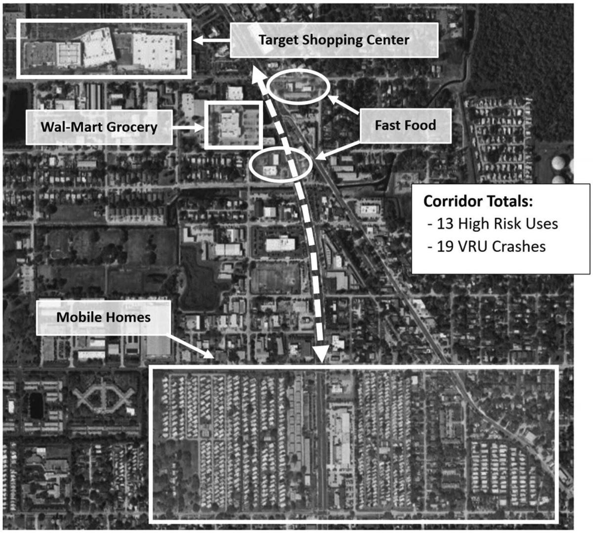
The research shows a very strong correlation between the location of household-supporting businesses on urban arterials and the devastating crashes. Dumbaugh and Stiles use the example of an urban arterial with a Target, a Wal-Mart grocery store, and fast-food restaurants about a mile from a large number of mobile homes. The corridor shows 19 crashes involving vulnerable road users during the time studied, resulting in deaths and chronic injuries.
The researchers advocate that planners take an active role in relocating household-supporting businesses away from hazardous locations. “Addressing this risk demands a shift in planning practice: revising zoning and site-planning standards to explicitly account for safety, redirecting high-risk uses away from arterial corridors, and applying analytic tools that identify and mitigate latent land use hazards during the planning and project development process.”
In effect, this means moving businesses off of arterial roads, where they are mostly located currently and where they want to be. The researchers mention the daunting task of reforming the design of urban arterials—moving the likes of Walmart, Target, Wegmans, and McDonald's would likely be no easier.
The authors note that retail stores typically have a 20-year lifespan, which presents planners with an opportunity to update zoning and regulatory plans over time. Roads, by contrast, often have a lifespan of 20 to 50 years before requiring complete reconstruction, but they do require more frequent resurfacing, which is an opportunity to reconfigure travel lanes, paint crosswalks, and make other changes.
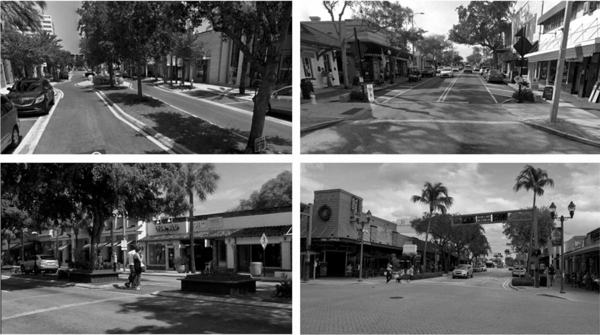
This paper presents two options as safer locations for household-supporting businesses. One is the traditional main street. These were typically designed and built before 1950 and are often laid out on a connected network of streets. These districts allow for substantial pedestrian and bicycle activity, and yet vulnerable users suffer far lower levels of injuries and fatalities, the authors report.
Option two is to simply move the businesses into a cluster some distance away from the corridors and major intersections. This has the effect of reducing fatalities and injuries, the study reports, but would likely not support pedestrian activity because there is no proximity to residential and mixed-use areas. This concept, it should be noted, could be implemented by planners independently, without asking traffic engineers to change their approach at all.
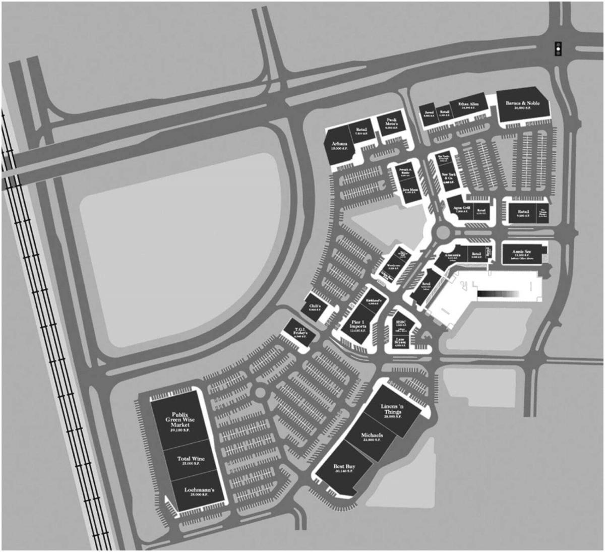
From the point of view of the urbanist, public safety, and human well-being in general, one of these approaches is clearly inferior.
This research examines only crashes involving vulnerable users. The second approach reduces those kinds of deaths and injuries but would likely have little effect on crashes involving only automobiles, which account for about 80 percent of traffic fatalities. The reason is that the second option removes businesses' direct access to arterials but leaves sprawl patterns in place. We know that sprawl produces higher vehicle miles traveled (VMT), thereby increasing risks to drivers and passengers.
Likewise, the second approach would not make pedestrian and bicycle access to these businesses any easier (it may make it more difficult). It wouldn't address the health, social isolation, and infrastructure costs associated with sprawl.
The better answer, option one, is to promote the kind of traditional mixed-use environments that New Urbanists and many other planners have advocated, but that traffic engineers have often resisted in practice. That can't involve just restricting businesses to existing walkable places; there are too few of these. We have to make new ones and reform automobile-oriented commercial districts. The authors are absolutely correct that planners must take a larger role. And yet this approach would also involve substantial changes to traffic engineering practice—planners could not go it alone as they could with option two.
Such a project would require a close coordination of land-use and transportation planning, something that New Urbanists have been calling for. Florida, in fact, has a relatively recent context-based street classification system to better coordinate land use and transportation, which could serve as a model for integrating land use and transportation in a way that truly addresses Vision Zero. (This approach was not part of the study).
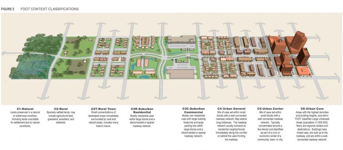
Walkable neighborhoods don’t just have streets designed for safety and lower speeds; they also have well-connected street networks, human-scale building frontages, and a mix of uses. Florida’s system uses the Transect, which can coordinate all these factors.
A system that uses the Transect for transportation planning could, over time, ensure that household-supporting uses are located more safely. The reality is that we don’t have enough walkable neighborhoods; we need to create more to relocate household-supporting businesses over time. The authors don't specifically endorse the context-based classification system, but they do point out that the role of land use in road safety is undervalued.
“In this article, we have sought to demonstrate that land use decisions play a profound and largely unacknowledged role in the death and injury of vulnerable road users,” the authors explain. “Through the adoption of zoning ordinances that locate household-supporting land uses such as groceries, fast food, pharmacies, and convenience stores along arterials, U.S. planning practice continues to place essential household destinations in environments that are structurally incompatible with pedestrian and bicycle safety.”
Here's a link to the study.