
Greenway planned for a community seeking identity


Amelia, Ohio, is a former village that disincorporated in 2019, splitting its land between two townships, Batavia and Pierce. (This decision made national news.) Amelia’s Main Street is a busy four-lane state highway, the Ohio Pike, which is hard to cross and dangerous for pedestrians. A partnership between the two townships worked with CNU to sponsor a Legacy Project led by ZoneCo to plan a more walkable community.
Legacy Projects leverage CNU’s planning and design expertise to make a long-term impact on the host region of its annual Congress—CNU 32 will take place May 15-18 in Cincinnati, about 20 miles west of Amelia.
“Through its history, Amelia has been and continues to be a place of movement without a place to stop and linger,” explains Sean Suder of ZoneCo, who teamed with illustrator David Pearson for the charrette in March. “That includes movement in and out of Clermont County to Cincinnati, movement of cars between the suburbs, movement of goods, mail, and regular production. But with all of the movement, Amelia got passed by. It never really figured out how to encourage people to stop moving and settle in.”
Ohio DOT opposes changes to the Ohio Pike (State Route 125, also known as Main Street), making the physical transformation of the roadway unlikely. Yet more than 100 participants expressed an appetite for better walkability along the corridor, which receives 30,000 cars daily. Rather than fight a losing battle to redesign the Pike, the participants shifted their attention to linking a network of walking paths through the community.
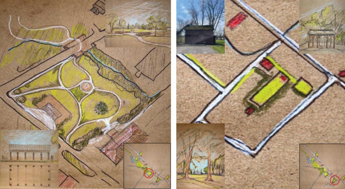
“During our breakout sessions, it became evident that there is a strong desire for improved walkability along the corridor. Despite sidewalks, they are not considered safe due to the high volume of traffic passing through the old village of Amelia,” explains Taylor Corbett, director of planning and zoning for Batavia. “Participants emphasized the need for interconnected green spaces to alleviate the stress on pedestrians. Our proposal involves ‘shifting the center’ of focus south of the corridor. This plan aims to create interconnected green spaces and establish a pedestrian-focused node that provides access to businesses along the corridor, as well as connecting to community gathering locations.”
Edward McCarthy, director of community development and planning for Pierce, notes that residents said that they wanted to travel the neighborhood on foot to socialize and access goods and services—but that existing infrastructure is inadequate. The plan “details a greenway trail system and focal town center park that connects multiple neighborhoods and community assets such as the library and elementary school on both sides of State Route 125,” he says. This project would make logical connections throughout the community for people of all ages, in addition to “creating a more town-centered space that can be activated through events and social gatherings.”
That central space is at the heart of the former village, across from the current library. It’s near the post office, and a fire station is planned. “It’s got a nice, flat, open green space with a natural amphitheater for concerts,” Suder says. “Food trucks could be provided for events.” Currently, Amelia has no place to celebrate special events, such as sports team victories or holiday parades. This would create a space that is a center.
The proposal is very lean, which means that it could be put into effect soon with limited resources. “It is implementable,” explains Suder. “They already own the land. No regulatory changes are needed, and they don’t have to subsidize development.” This is not a typical new urbanist plan, but it addresses placemaking and enables multimodal travel in a drive-only environment. The team also looked at other kinds of amenities, such as a microbrewery with outdoor seating and attractions.
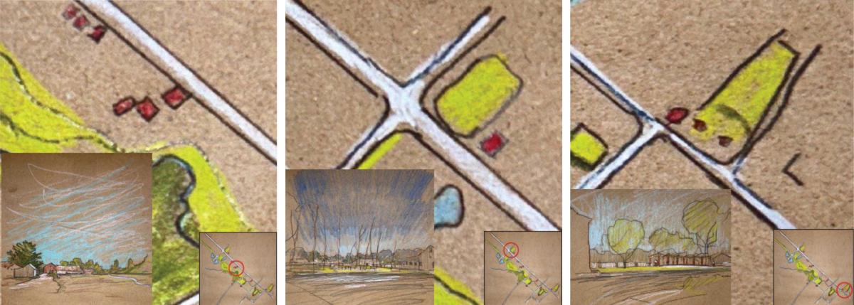
“The Pike is scary,” Suder says. “On the pathways, it is safe and quiet, and you hear birds chirping. This could be where you could buy a house cheaply and walk to a cool brewery, the post office, the school, and the library, and now you have something.”
The two best current pedestrian crossing points of Route 125 are at the east and west ends of the proposed greenway, near existing and planned amenities. “I don’t see anyone, including ODOT, making any proactive improvements, so if things take off, then maybe we will see something like raised crosswalks, more lights, or even a pedestrian bridge,” Suder says.
Residential development is taking place in the area, but the market is weak. More amenities would strengthen the market, making more compact residential forms feasible in the future, Suder explains. That might raise the possibility of more fundamental changes—but for now, safe pedestrian paths would improve the quality of life. The plan will be presented along with other Legacy Projects at CNU 32. More details are on the web at pikewithapurpose.com.
