New urban fabric planned for old textile town


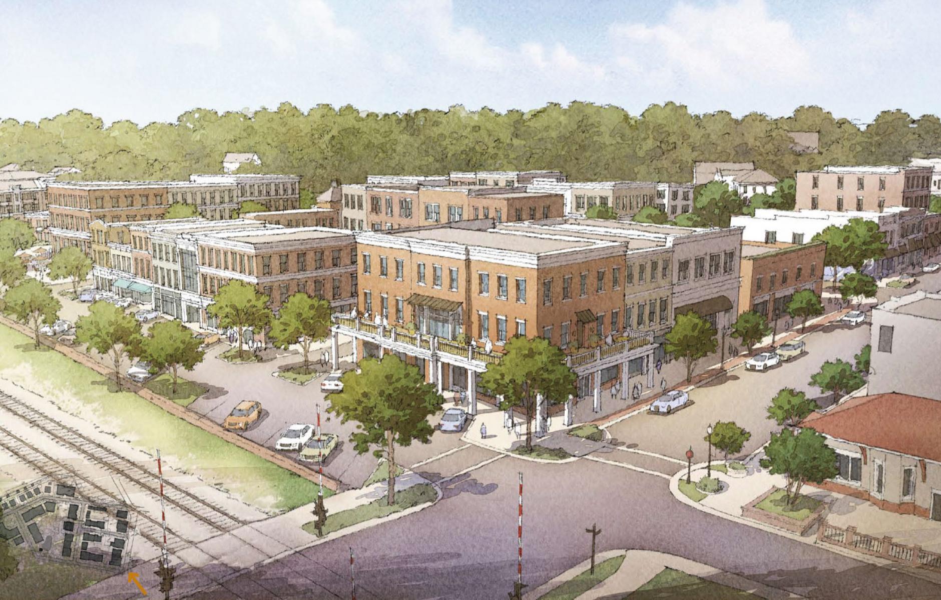
A 15-acre planned main street expansion would double the downtown of a 150-year-old former textile town near Charlotte, North Carolina. In the 1990s, Belmont was one of the first municipalities in the US to adopt traditional neighborhood development coding, later called form-based coding—designed to enable walkable, mixed-use neighborhoods.
The town of 10,000 is experiencing a new period of rapid growth. Proactive planning led by Historical Concepts of Atlanta was undertaken to shape vacant land adjacent to Main Street. The plan recently won a 2023 Urban Guild Award for Design Exploration.
In one of the more compelling urban design ideas, the plan extends the street grid through what is planned as an expanded downtown neighborhood. Two streets ending at Main Street would be lengthened and ultimately connect to the next north-south street to the west. Belmont is using the plan as a guide to update their comprehensive plan regarding this key site.
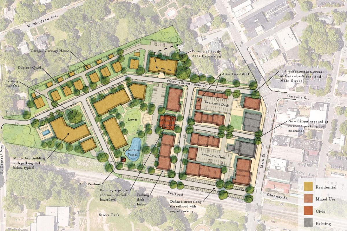
The extension of Catawba Street westward is made possible by relocating the old city hall—now the site of the Chamber of Commerce and the Downtown Belmont Development Association. The 1950s building is positioned in a place of honor in the plan, terminating a new mixed-use street. The rear of the building would overlook a shared mid-block park. “By putting the old building at the center of the plan, it creates an instant gravity of historic character,” notes Ryan Yurcaba, project manager for Historical Concepts. Today, the building needs substantial renovations, which makes this move and transformation into a community event space a reasonable endeavor.
Nine acres of the site comprise the estate of a family that helped to found Belmont as a mill town. That parcel is combined with smaller lots fronting Main Street and surface parking owned by the city. The plan was developed with the support of the city and stakeholders. The owner of the larger parcel is currently working with the city and a Charlotte-based consultant to select a suitable developer, who may be identified in early 2024.
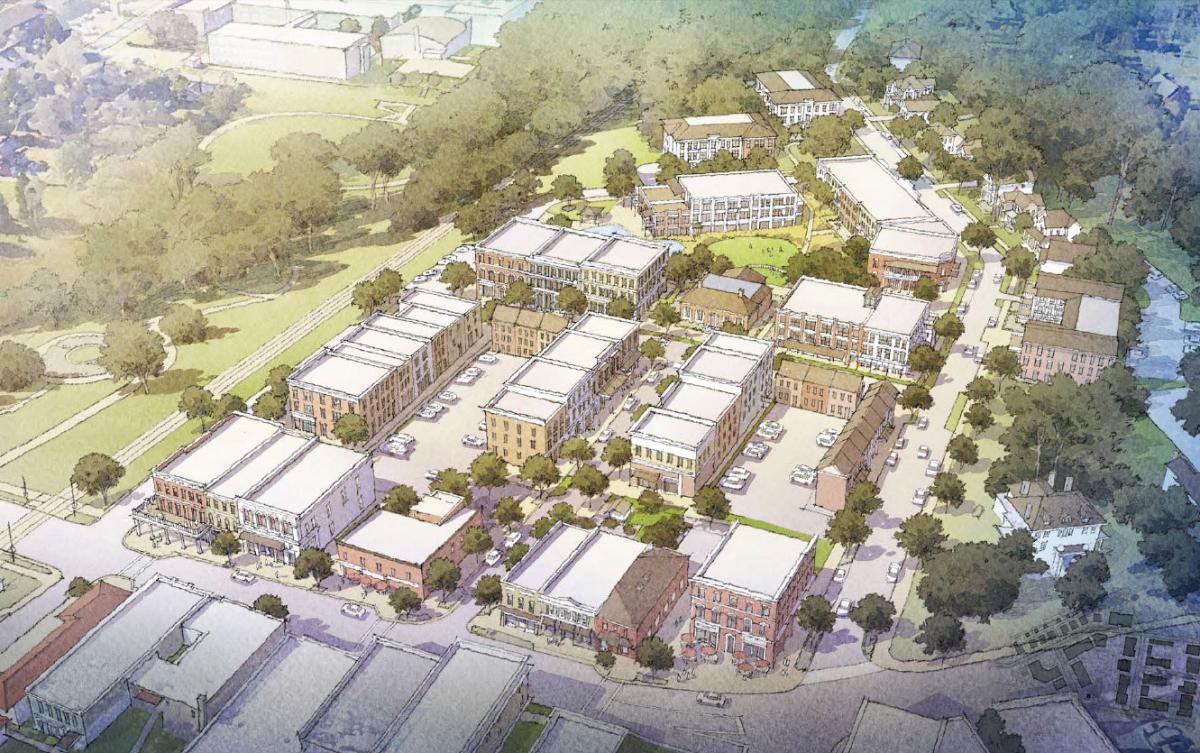
The plan shows mixed-use, commercial, and residential buildings two to four stories in height, in a style inspired by the turn-of-the-century brick main street structures in the historic downtown and other regional precedents.
The site has been the subject of plans before, but the city rejected these because they did not meet the land-use code or goals of the comprehensive plan. Previous plans did not have a mixed-use component and featured taller buildings in suburban layouts, which did not fit Belmont’s historic Main Street context. Current plans generally meet the code and fit into the historical context better.
“Analysis of historic development patterns informed the planning process: a place-based approach that resulted in universal support, paving a path forward in a community that had previously denied multiple proposals,” according to Historical Concepts. “The literal weaving of the town’s historical past into the new downtown block ensures a level of authenticity as the core district doubles in size.”
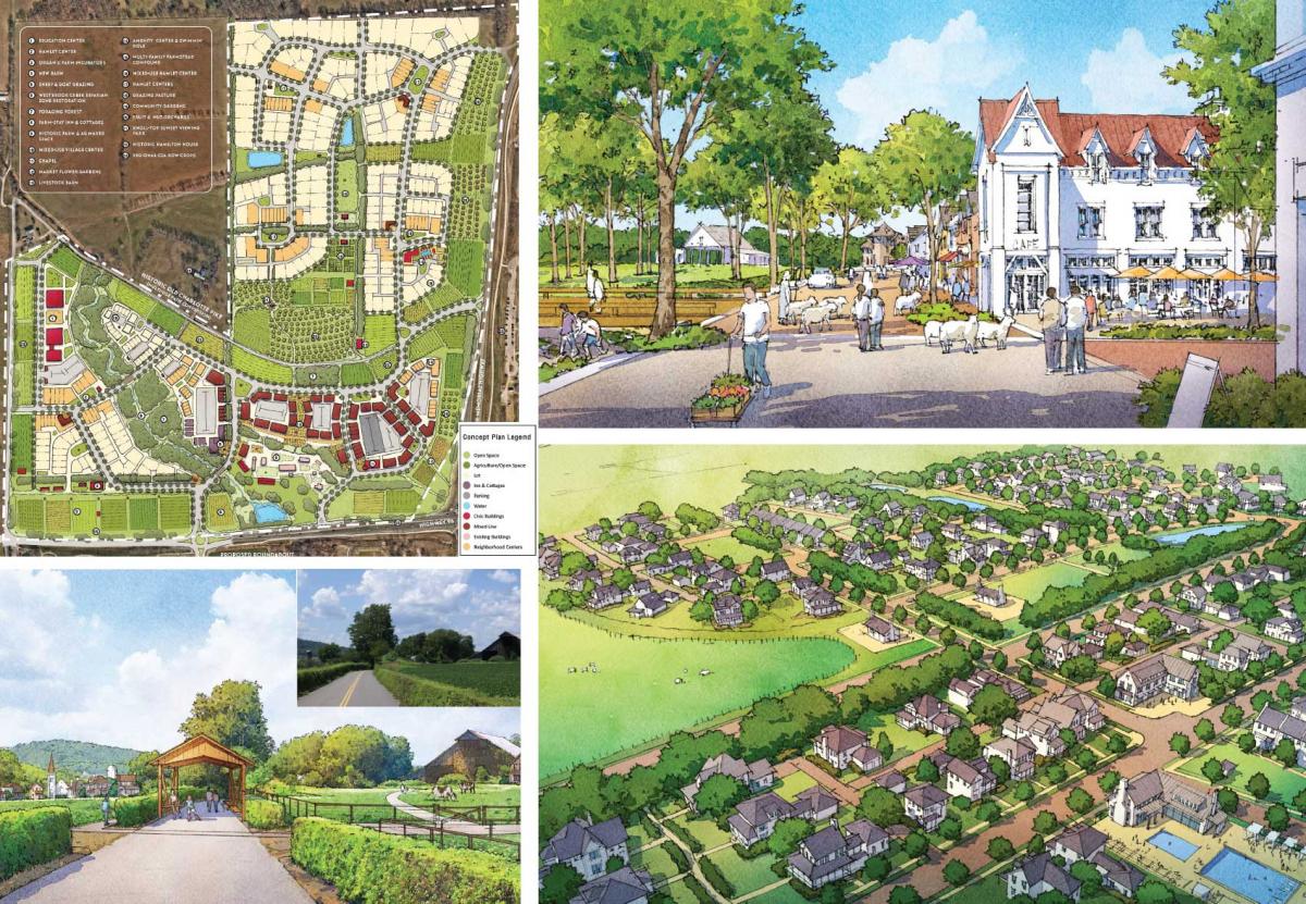
The Urban Guild also announced a Merit Award for Design Exploration to the Short Farm Agrihood in Franklin, Tennessee, designed by Town Planning & Urban Design Collaborative. The firm partnered with the Short family, which has farmed the 200-acre site for 135 years. The intent is to create a village with 50 percent of the land preserved for agricultural use. The site is across a surface highway, State Route 96, from a large existing traditional neighborhood development (TND) called Westhaven. With the adjacent TND, urbanism may coalesce in the future, support transit, and connect with the historic town about two miles away.
Editor's note: This article addresses CNU’s Strategic Plan goals of working to change codes and regulations blocking walkable urbanism and advance design strategies that help communities adapt to climate change and mitigate its future impact.
