A regional missing middle strategy


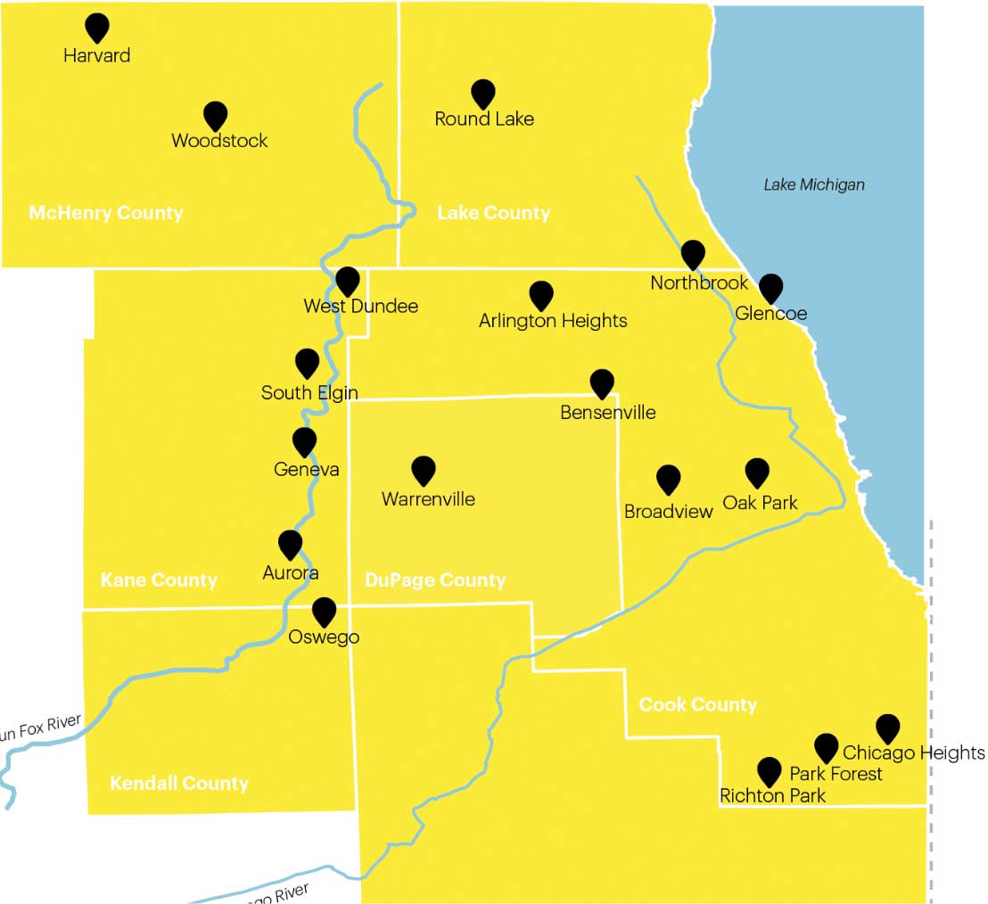
Eighteen municipalities, totaling about 600,000 people, collaborated on a Missing Middle Housing Toolkit for the Chicago Region in 2025. “At its core, the toolkit promotes a shift in zoning and planning that better supports diversity, affordability, and sustainability,” says Opticos Design, who created the toolkit for the Metropolitan Mayors Caucus and funded through the support of the Richard H. Driehaus Foundation.
What’s interesting is that missing middle is usually a tool used at the building, block, and street scale. Here it is being applied at the regional scale. To be clear, if this project results in any Missing Middle Housing, it will mostly be at the small scale, unless a neighborhood-scale project includes missing middle. There will be no regional-scale missing middle developments. Yet part of what makes the New Urbanism robust is that it can operate at multiple scales simultaneously.
The cities range in population from 8,000 to 180,000 and vary widely in urban form. Oak Park, bordering on Chicago, has a density as high as the core city and is a fully walkable urban community. Many other cities are inner-ring suburbs, and still others are located on the far outskirts of the region. The toolkit highlights the wide range of applications for Missing Middle Housing.
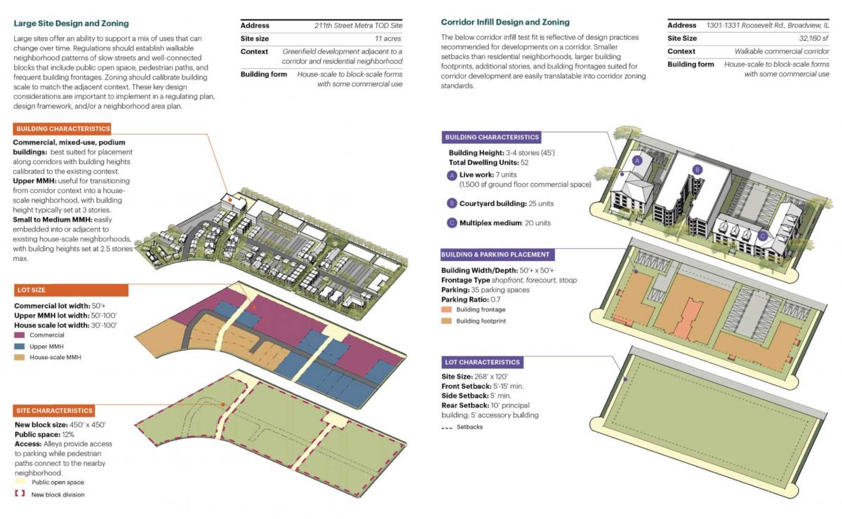
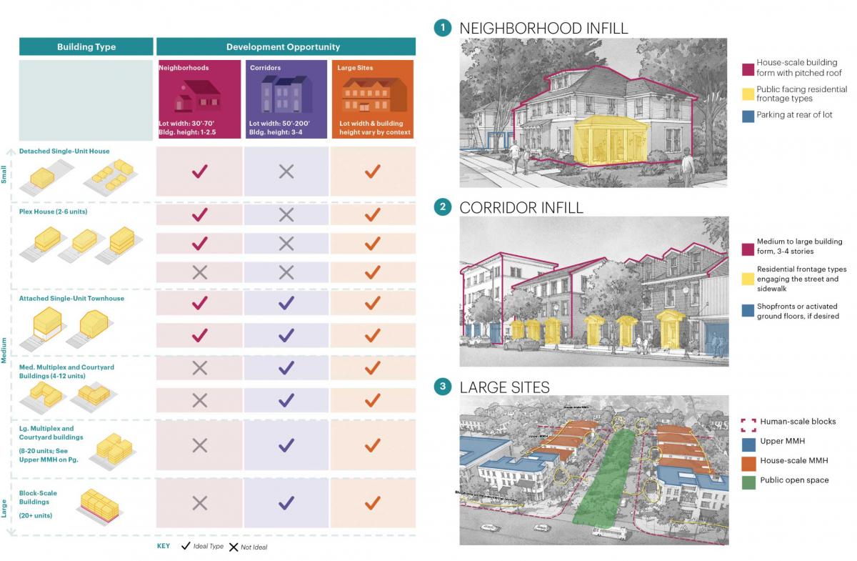
Three types of sites were identified across communities, Opticos notes:
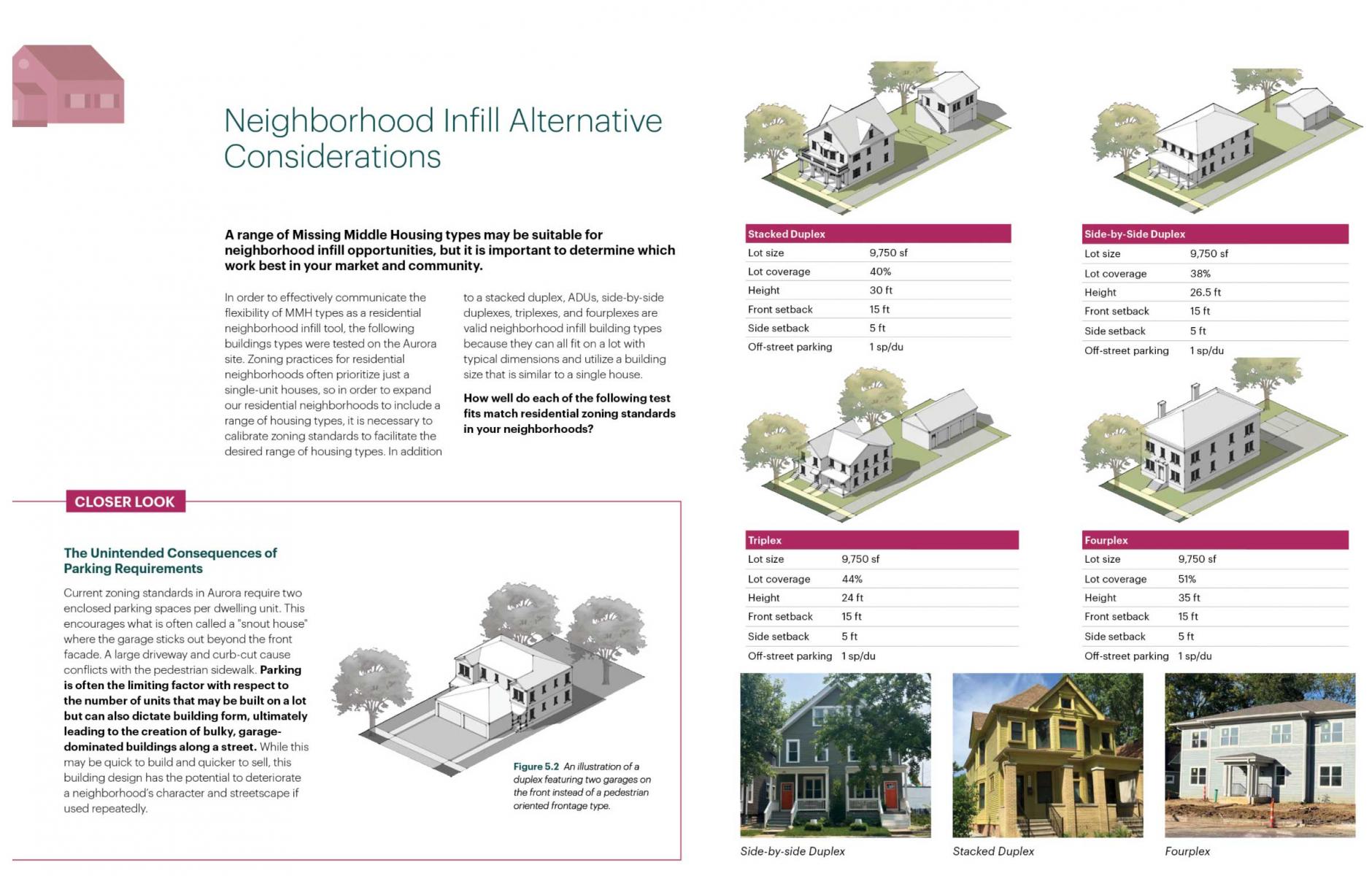
- Neighborhood infill: Communities can calibrate zoning to ensure that allowable MMH is compatible—in both building footprint and height—to the surrounding neighborhood, utilizing ADUs, duplexes, and small multiplex types. Communities with a large number of vacant lots may consider a broader range of types to provide more development feasibility, while limiting the potential for consolidation of lots that may lead to out-of-scale buildings.
- Corridor sites: Many communities are faced with vacant properties along often struggling commercial corridors. While communities often zone these sites for commercial use only, zoning can start to incrementally introduce more housing to these corridors, adding residents to support nearby businesses and services.
- Large sites: Communities can consider how the location, shape, and natural features across the site could guide the location of streets, open space, and missing middle housing types.
The toolkit covers a wide range of housing-related topics, including building types, zoning, parking, site design, lot coverage, and others. In terms of barriers to change, setbacks are a concern because they often restrict missing middle housing. The Toolkit identified best practices: Front setbacks of 10-20 feet, depending on the context (this could be smaller in neighborhood centers). Side setbacks of no more than 7 feet. Rear setbacks of 10 feet for principal buildings and five feet for accessory dwellings.
Jennifer Settle, who led the project for Opticos, notes that the collaboration and interaction between municipalities was the project’s most important aspect. The primary deliverables were the 1) Peer Network meetings that covered a specific topic (selected by the communities through an initial survey and feedback loops following each session); 2) The site studies which were selected from sites submitted across all the communities; and 3) the Site Planning + Building Type exercise that brought local leaders and planners together to explore how zoning and building types work on typical lots, she says.
Opticos reported that “in 6 months after the release of the toolkit, approximately 20 percent of the 18 municipalities had taken an active and public next step based on project recommendations.”