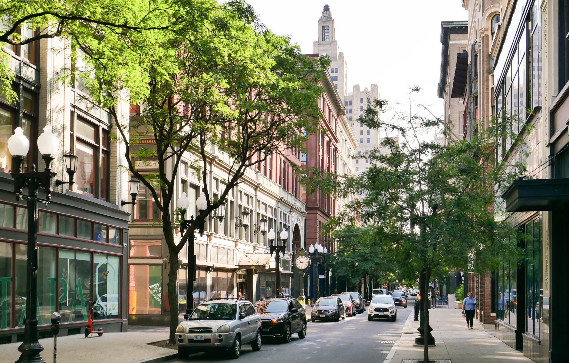
We plan cities backwards


Cities endure for millennia, but not everything in them is equally durable. Streets, public spaces, monuments, and boundary lines that face the right-of-way—major aspects of the public realm—survive for hundreds or thousands of years. Land uses, landscaping, traffic signals, signage, and lighting are much more fleeting. Even buildings last an average of 80 years, although some stand for centuries.
For most of American history, urban planning emphasized the permanent aspects of cities—especially streets, which are the most enduring of all. But since the mid-20th Century, we have inverted that emphasis and focused on the ephemeral aspects, especially land uses, through zoning. Street patterns are left mostly to the short-term interests of the private sector.
That’s why cities built since roughly 1950 are disconnected and chaotic compared to cities planned before then, argues Paul Knight, an urban planner with Historical Concepts who is writing a book titled The Urban Form Standard, which is available online as a partial draft.
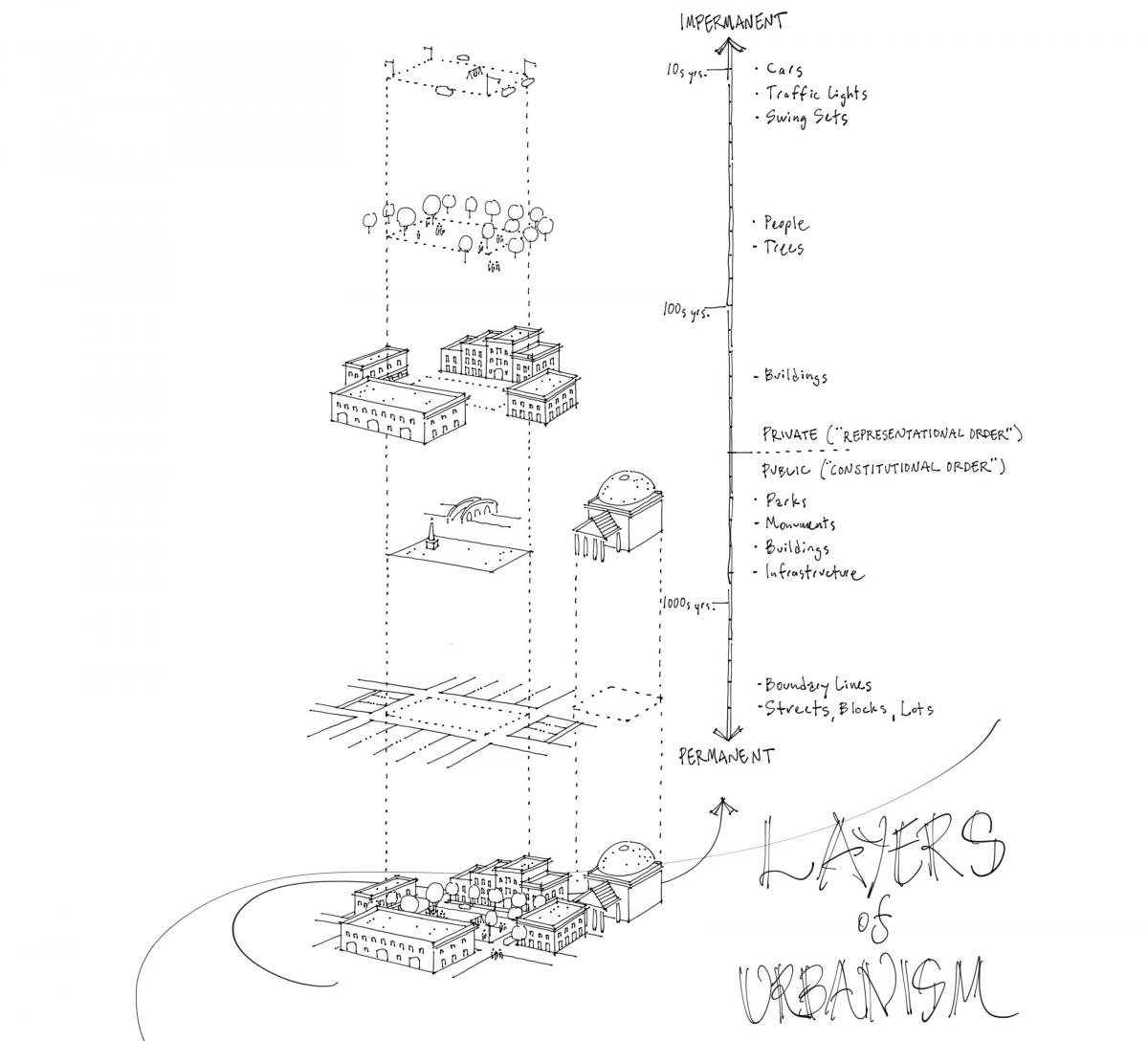
Of all the long-lasting elements, “streets are the most important,” Knight says. Streets are collectively owned assets that are improved over time. They are bounded by property lines with legal rights that pass from one owner to the next, one generation to the next. This gives streets their permanence. This has been demonstrated by major disasters such as the Great Fire of London in 1666 and the San Francisco earthquake of 1906, both of which destroyed most buildings in their respective cities.
After these catastrophes, planners sought to rebuild on new, modernized street patterns. In both cases, the old streets and boundary lines reasserted themselves, and both London and San Francisco were rebuilt with their old street networks.
Getting streets right therefore has very high stakes. When we get them wrong, we curse future generations to live with our mistakes, explains Knight. By contrast, a master street plan is a blueprint for a city. Developing a city without a street plan is like constructing a building without a blueprint—and letting each subcontractor decide independently where each element should go.
Another analogy that Knight uses is a jigsaw puzzle. A street plan is like the picture on the box. Imagine putting together that puzzle without the picture, with many people working separately and many ways to assemble it. The end result would be a jumble, because those working on the puzzle would have no idea what they are aiming at. With the urban form—the street plan—clearly in mind, public officials, developers, citizens, planners, architects, and others share a collective vision for the city's future.
Whether a city has a street plan or not profoundly impacts the quality of the place. Paul Knight has studied more than 100 neighborhoods designated Great Places in America by the American Planning Association, and they share one thing in common—they began with a master street plan. Famous examples of street plans include the L’Enfant Plan for Washington, DC; The 1811 plan for Manhattan; William Penn’s plan for Philadelphia, which was enormously influential; and the Oglethorpe Plan for Savannah. All were built out and continue to shape their respective cities centuries after their conception.
I tested the hypothesis by systematically reviewing the Great Places in America, as designated by APA from 2007 to 2019, and found it to be true—essentially all are located within street plans projected by public officials. Most are the result of simple grids—others are built from more complex plans created by town planners. They are fine-grained street networks with small blocks built before 1950.
In the middle of the 20th Century, the late 1940s to be exact, cities gave up on exercising their power to project street plans onto private property. That power to lay out streets was ceded to private developers, who built streets for individual real estate developments. And that is how our cities have grown ever since. This has created a patchwork of street systems that do not connect and form no coherent whole in sprawling urban regions. Many people look at our messy metro areas and see a lack of planning, and, in a sense, they are right. Despite the proliferation of planning bureaucracies, there is no overarching vision for the city. Planners intensely regulate land uses, which are ephemeral, and buildings, which last an average of 80 years, but are laissez-faire about local street networks, which survive an order of magnitude longer than buildings.
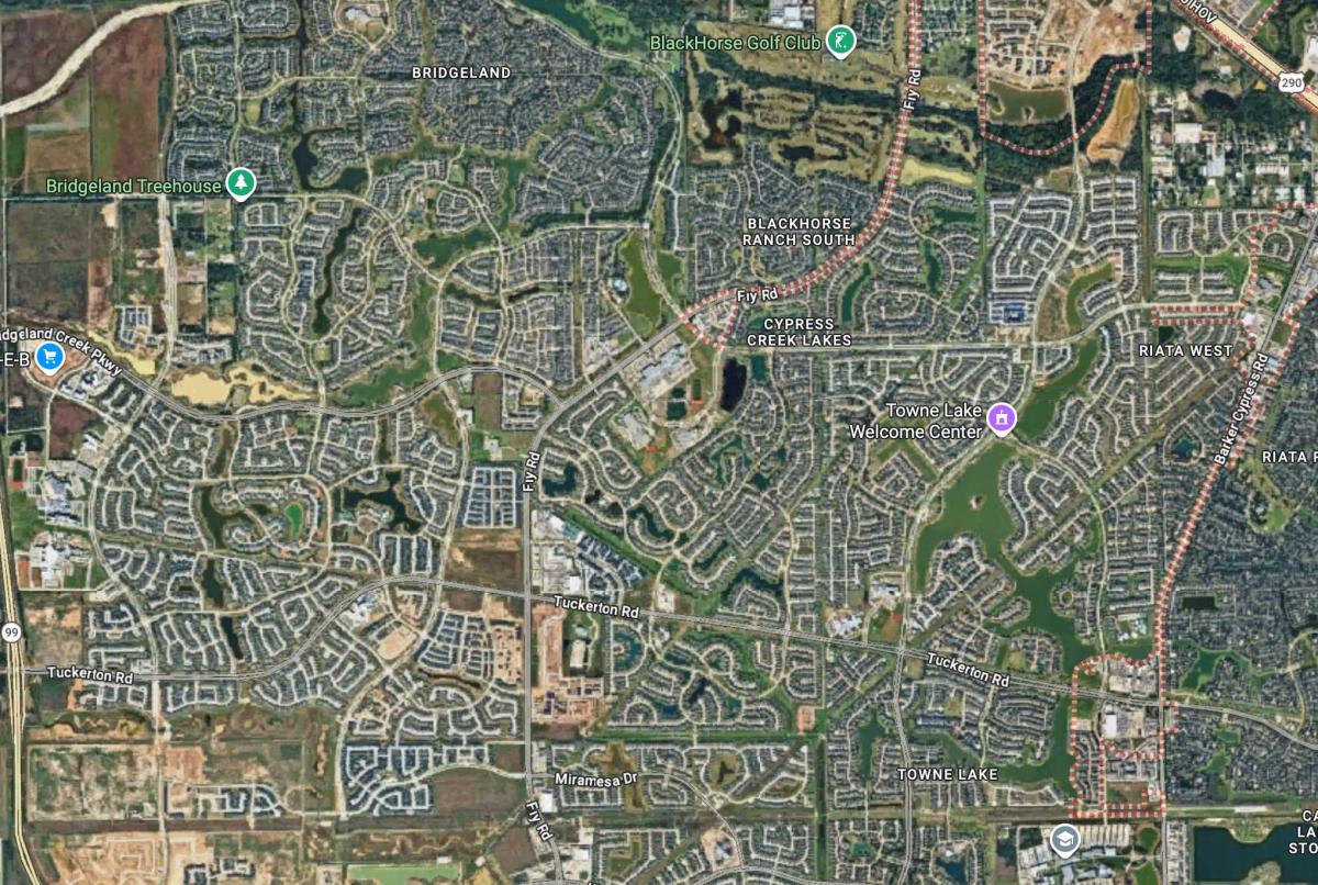
Our metro areas end up looking like an unplanned mess. Households are burdened with high transportation costs. Life in many cities became expensive. Big builders and developers thrived in the system, not small builders. It became a big, inefficient machine, and now we are paying the price.
And streets are not just for mobility. They create frontage, without which there would be no city at all. Virtually everything built in a city fronts a public right-of-way. “Frontage is the face of the city. It's the ground-floor edge where private property meets public space, where buildings present themselves to the world. This edge (measured in linear feet) is where urban life happens,” Knight explains. “It's where shopkeepers arrange window displays, where people access their homes or places of work. Without frontage, you don't have a city.”
The frontage is the economic and social lifeblood of cities. The old system of master street plans produced large quantities of very efficient frontage, whereas the current system is inefficient, Knight says.
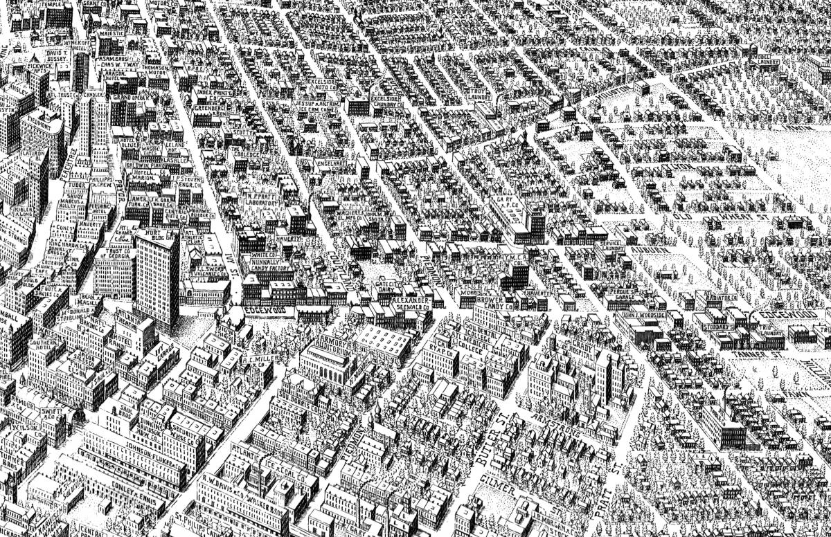
Consider two hypothetical 100-acre developments, he explains:
“The first follows a traditional pattern with blocks roughly 300 by 400 feet. This creates about 26 blocks with over 36,800 linear feet of frontage. If each block supported 20 ground-floor businesses or entrances, the entire development might have over 500 individual addresses, each contributing to street life.
“The second uses a modern suburban pattern with superblocks of 1,000 by 2,000 feet. This creates less than 2 blocks with about 10,800 linear feet of frontage. Each superblock turns inward, with parking in the center and maybe one or two entrances per side. The entire development might only have 30 addresses, sparsely located around the perimeter or oriented inward onto parking lots.
“Same acreage. One-third the frontage. One-sixteenth the number of entrances. Is it any wonder the second pattern feels dead despite consuming the same amount of land?”
The bottom line is that street plans are highly efficient ways to create frontage, and this was created in vast quantities in the 18th, 19th, and early 20th centuries throughout America. Consider what happened with Manhattan in 1811, when the commissioners hired John Randel to survey nearly the entire 21-square-mile island, north of a small portion of downtown that had been built. Randel surveyed and drew the plan on paper, after which he marked intersections with about 2,000 heavy marble “stakes” over a 19-year period—so landowners would know where to start building.
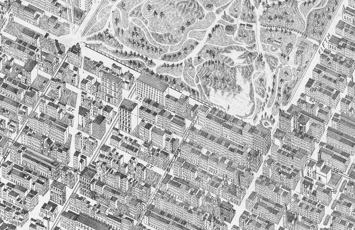
In one of the fastest-growing cities in world history, this single planning act created frontage that took more than a century to build. The streets were improved gradually. Construction began on simple dirt streets as they were cleared. Landowners were compensated for their land, and its value skyrocketed over time. The commissioners had no idea what would eventually be built on the streets. Skyscrapers and supermarkets were not invented. Neither were trains, automobiles, or elevators. The street plan accommodated all of it, and continues to adapt to modern life and technology.
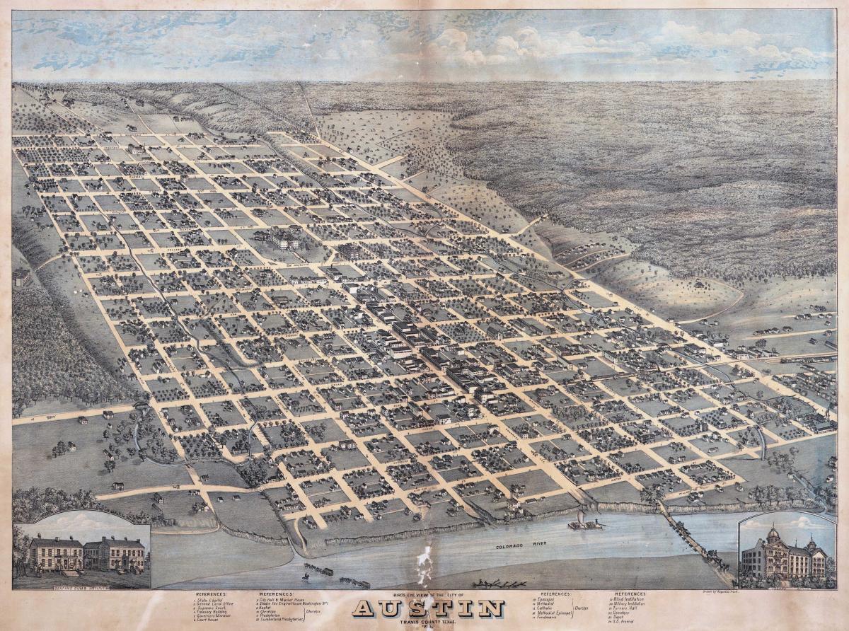
Although New York is a dramatic example, a similar process took place in thousands of settlements of all sizes across the US. Below is the original street plan for Austin, Texas, which now covers downtown. Notice how much room the city has to grow on these orderly blocks.
The Urban Form Standard explains why we abandoned street plans and consequently stopped building interconnected street networks. In the US, 1950 is a major turning point. Nearly all of what was built before 1950 is a grid or modified grid. After that, on a dime, we pivoted to curvilinear subdivisions that became increasingly disconnected. Zoning was part of the problem; the real problem was putting zoning first. In the 1920s, planners were still thinking of streets and public infrastructure first as part of “comprehensive plans,” and zoning second. But over the next two decades, as the new tool of zoning caught on across America, street plans were abandoned, Knight says. The coup de grace was delivered in 1947, when a court case—Bishop vs. Board of Zoning Appeals of the City of New Haven—officially redefined "comprehensive plan" to mean something entirely different from what was originally intended. A “comprehensive plan” was defined as “a general plan to control and direct the use and development of property in a municipality ... by dividing it into districts according to the present and potential use of the properties.”
In other words, comprehensive plans, the court said, should focus on zoning, and zoning is the tool for implementing the plan. Zoning became the be-all and end-all. The street plan was written out of existence immediately before it disappeared in the real world. I think Knight has revealed the murder weapon.
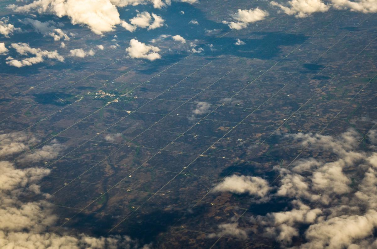
But jurisdictions still have the power to create street plans, and this remains constitutional. They could, if they so desired, design the picture on the jigsaw puzzle box so that everybody has a clear picture of what the community is aiming at. The Urban Form Standard describes four rules for street plans:
- Block size. Blocks should have sides greater than 200 feet and less than 600 feet, with a perimeter less than 1,800 feet.
- Block geometry. Blocks should be composed of straight line segments with preference given to rectangles. A long side to short side ratio of 1.5:1 or greater is also preferred.
- Rights of way. Most rights-of-way should have a width between 40 feet and 80 feet. A limited number of rights-of-way may be larger or smaller. (60 is the Swiss Army knife width).
- Alleys. Alleys should be between 10 and 20 feet in width and be present in most, if not all, blocks.
Not all street plans are simple grids, however; “Our analysis reveals that successful street networks tend to fall into five basic patterns, often in combination,” Knight explains:
- Rectilinear grids (regular rectangles and squares)
- Angular grids (straight streets at varied angles)
- Diagrammatic plans (expressing a single organizing idea)
- Curvilinear networks (following contours, garden suburb)
- Irregular patterns (organic evolution over time)
Knight’s book draft was written for the Doug Allen Institute. Allen was a professor of landscape architecture at Georgia Tech who taught a popular annual course on the History of Urban Form and had a profound influence on many students; the institute is dedicated to sharing the principles of urbanism that Allen taught. He died in 2014, but his lectures are available online.
Allen argued that planning should focus on what is permanent, the most long-lasting aspects of cities, which have the most impact in the long run. Those aspects comprise the public realm, and most importantly, streets.
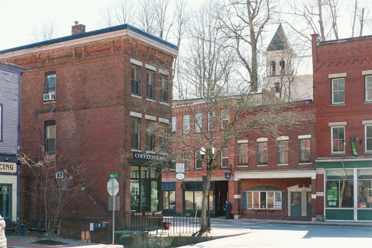
The Urban Form Standard offers a different take on urbanism—one compatible with New Urbanism; Knight is a New Urbanist—but with a stronger emphasis on history. A historical view of the built environment reveals what is most permanent and what is most ephemeral. The Urban Form Standard is grounded in the process by which cities, especially American cities, were built, and the lessons we can take from that. It's a rich history.