Envisioning Hartford: infrastructure, equity, and renewal at a critical crossroads


As federal, state, and city officials move forward with plans to reconstruct Interstates 84 and 91 through Hartford, Connecticut, a rare opportunity emerges to repair the city’s fractured urban fabric and revitalize its economic base. For decades, motorists have sped through Hartford, unaware of its walkable neighborhoods and pre-automobile architecture—vestiges of a city once defined by human-scaled design. Now, with growing public consensus around reversing the damage caused by mid-century expressway construction, the case for replacing Hartford’s aging infrastructure has never been stronger.
The challenge is formidable. Hartford’s downtown office market remains weakened by the COVID-19 pandemic, and the city’s historic strength in banking and insurance has been diminished by corporate consolidation and outmigration. To break the cycle of fiscal instability now confronting many small and mid-sized American cities, Hartford must prioritize investments in place-based assets—those that cannot be relocated elsewhere.
Yet Hartford is not standing still. With a population of 120,000, the city is actively pursuing strategies to attract residents and investment. The Capital Region Development Authority has spurred new business activity, while demand for multifamily housing remains robust. Historic preservation efforts and high-profile public investments—such as the development of a popular new ballpark, the expansion of the UConn Hartford campus, and ongoing plans to revitalize the Civic Center Arena and the Washington Street corridor—signal momentum.
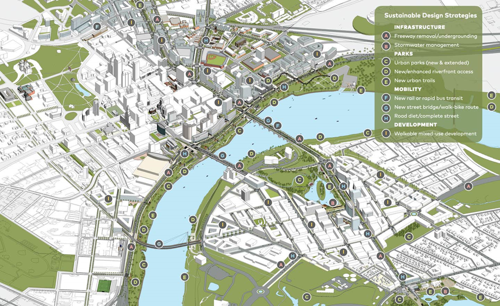
Among the city’s most promising current initiatives are the Hartford 400 plan and the Greater Hartford Mobility Study (hartfordmobility.com), the latter developed in collaboration with the Connecticut Department of Transportation (ConnDOT). Backed by U.S. Representative John B. Larson, both efforts are designed to rectify planning decisions of the past by ensuring meaningful public engagement and equitable outcomes.
Enter Envision Hartford, an ad hoc working group dedicated to exploring strategies to remove or mitigate the physical and social impacts of I-84 and I-91. The group brings together a range of expertise—from transportation planning and disaster relief to economic development and architecture—to evaluate the environmental, recreational, and economic development potential both highway replacements could yield. Its aim: to introduce a new model for placemaking and vernacular urbanism favoring small-plot development around parks and open space—patterns of growth once dominant in American cities, disrupted mightily during the 20th century, and back in demand in the 21st.
Matt Mocarsky, Envision Hartford spokesperson and Frog Hollow resident, emphasizes the stakes: “Retaining and attracting young talent is critical to Hartford’s commercial success, and we’ll need a restored, sustainable urban fabric to do so. Practically speaking, that means a repair process putting access to the Connecticut River first, prioritizing people over cars, and evolving our infrastructure to render Hartford more competitive for investment.”
Envision Hartford’s members include a keyboard musician with expertise in transportation and urbanism, a community advocate and business professional living near the shroud of I-84, a craft brewer promoting development and regional growth, and this author, trained in architecture and urban design with direct experience engaging the planning discourse in the lead-in to Boston’s “Big Dig.” The group’s first collaboration emerged in response to ConnDOT’s preliminary plans for replacing the obsolete, elevated I-84 viaduct. An unsightly structure driven through the city in 1965 at the height of America’s car-centric planning era, I-84 cut off many neighborhoods from one another both physically and psychologically. See (https://commonedge.org/did-a-highway-kill-the-city-of-hartford/).
When the Connecticut DOT announced that costly renovations were necessary to maintain the viaduct, the idea to solicit input gained support and helped launch the HUB of Hartford Steering Committee, a citizen’s advocacy group that studied alternatives to replacing the viaduct. Seeing a need for an even broader analysis, that effort catalyzed creation of the Greater Hartford Mobility Study, an assessment for regional mobility, including concepts for replacing Hartford’s other major eyesore, Interstate 91.
Released in early 2024, the Study promotes a diversified transportation system that includes expanded rail service, improved pedestrian and bicycle infrastructure, and transit connectivity to Bradley International Airport. Serving 1.3 million residents across 53 towns, the study envisions Hartford as a more connected, competitive alternative to Boston and New York.
Strategist and North Downtown (NoDo) resident Micah Kerr expands on the vision: “We see a much broader dynamic regionally—where Hartford more aggressively expands its statistical transit-service area into Greater Springfield and the Upper Connecticut Valley influencing the geography "unclaimed" by NYC or Boston. The intent is to bolster the capital region’s cultural influence, business catchment geography and grow its economy and revenue generating potential. We look at Hartford as the 21st largest CSA, not the 41st largest in The United States, and we count 3+ million potential transit customers, not 1.5 Million.”
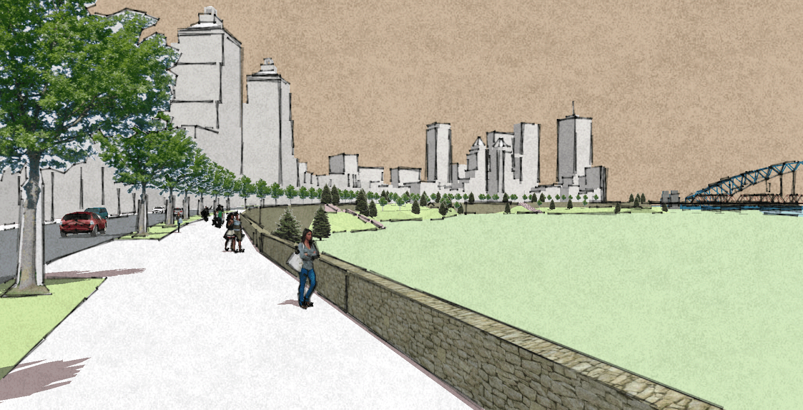
Riverside Crescent: A bold urban vision
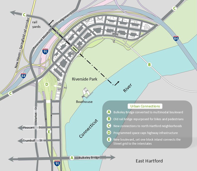
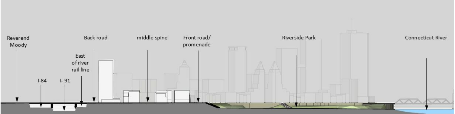
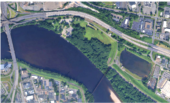
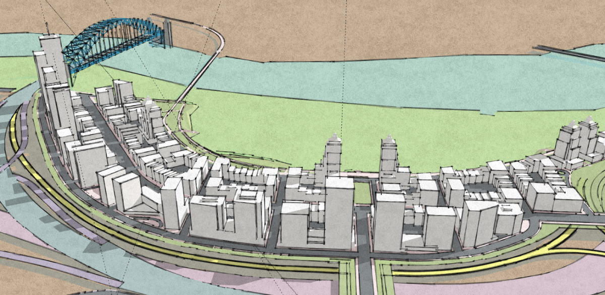
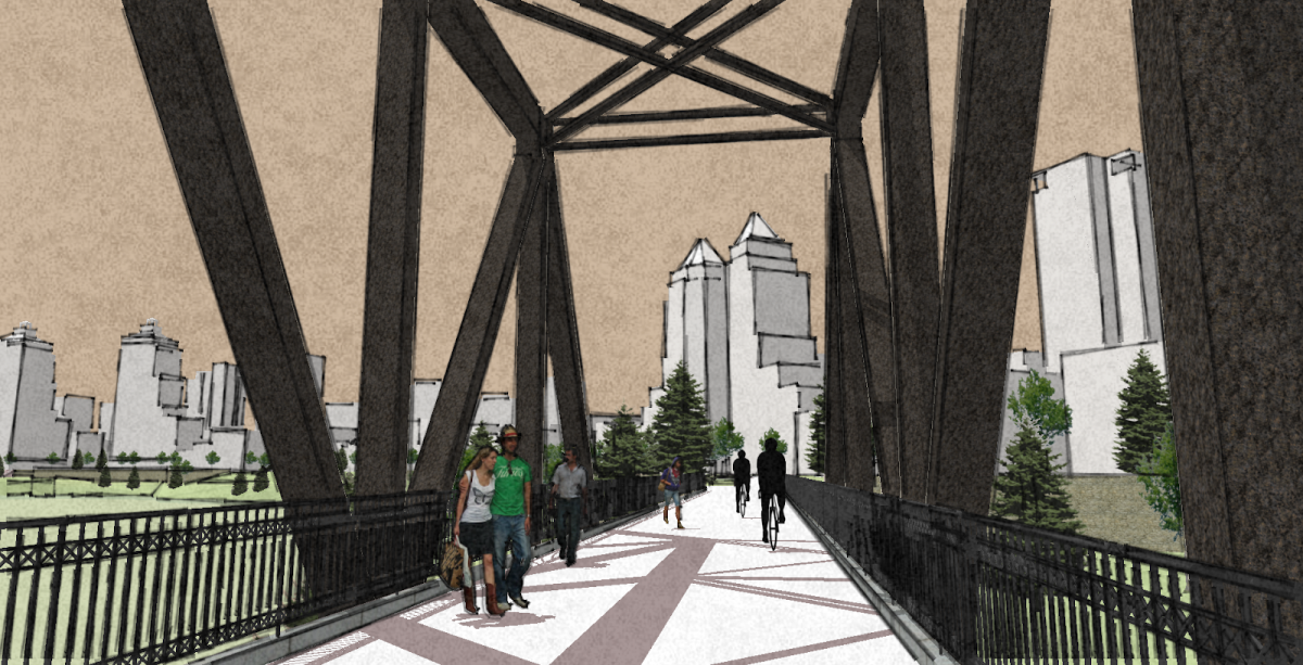
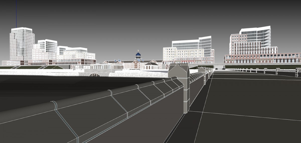
Envision Hartford’s first conceptual proposal—Riverside Crescent—imagines a reconfiguration of the I-84/I-91 interchange north of downtown. The concept calls for relocating I-91 westward, away from the riverfront, alongside a realigned I-84 corridor. This would unlock a multi-acre development zone with sweeping views of the river and city skyline. The existing I-91 alignment, built atop a 1940s-era flood-control berm, would be replaced with modern flood walls and berms integrated into mixed-use development.
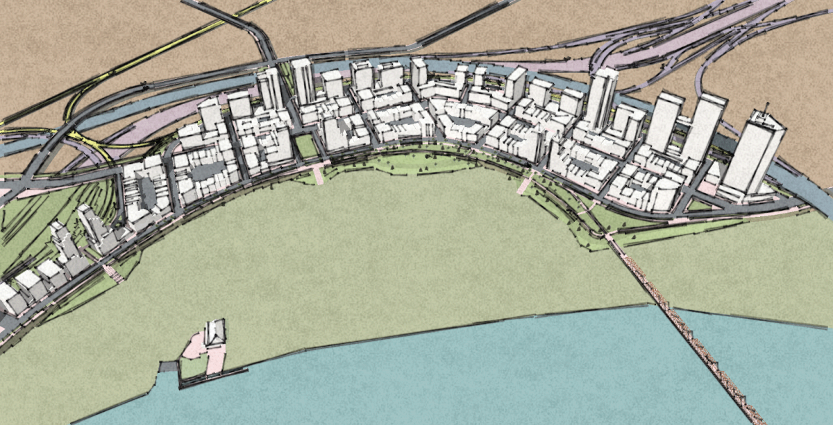
The transformation extends the NoDo and Clay-Arsenal neighborhoods eastward toward Riverside Park, for a new district reminiscent of Boston’s Back Bay. Bill Mocarsky, Envision Hartford’s transportation plan coordinator notes: “In our review of the (Greater Hartford) Mobility Study, we discovered the new interchange DOT anticipates is generic enough to warrant us investigating alignment options to better connect the city to Riverside Park. We’re confident Crescent can bring the city to the river AND work in concert with DOT’s highway design-performance criteria.”
Inspired by the Royal Crescent in Bath, England, and the esplanades of Rio, Paris, and Prague, the district would include taller buildings along its western edge—screening the highway— with lower-scale housing oriented east, toward the river. A pedestrian-friendly boulevard would anchor retail, residential, and research uses, supported by reusing a historic iron rail bridge to connect across the river to East Hartford.
Connecticut-based Architect Robert Orr, FAIA, a veteran supporter of the Congress for the New Urbanism supports the concept: “If stressed communities like Hartford are to sustain themselves with civil, walkable, intra-active neighborhoods, their planners should consider eschewing the expedient, large-footprint podium projects now dominating construction sites across the nation in favor of the diverse economic distribution benefits small-plot development can generate.”
Orr argues such development acts as an armature for social engagement, where local “micro-investors” accelerate tax generation as they reduce dependency on large-scale corporate financing.
“A formula where predominantly 5 to 6-story mixed-use structures are financed through smaller circles of investors encourages local participation, filling out and generating tax revenues sooner. The key is to revive, and codify, dense new walkable—socially amenable—small-plot development zones from the get-go. Riverside Crescent may be one such opportunity.”
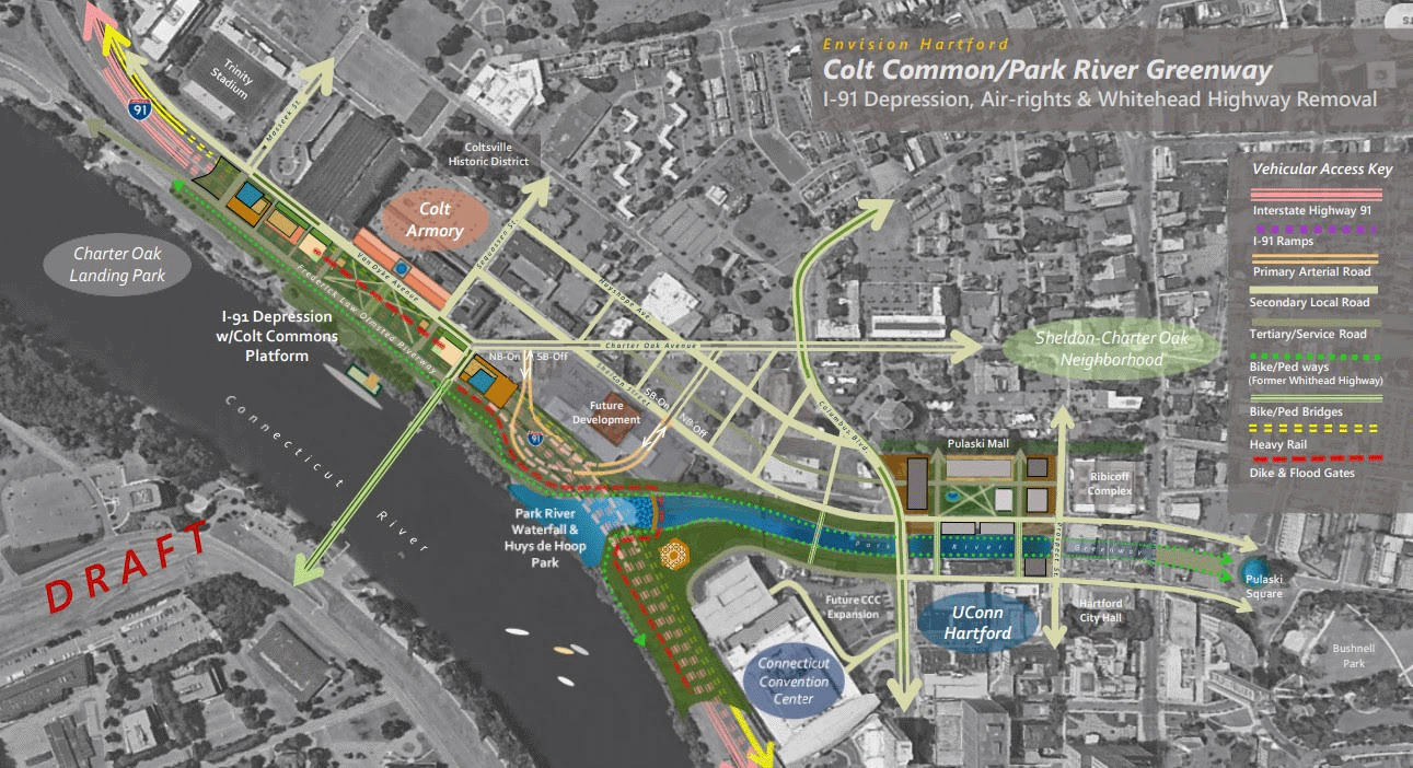
Colt Commons and the Whitehead Highway
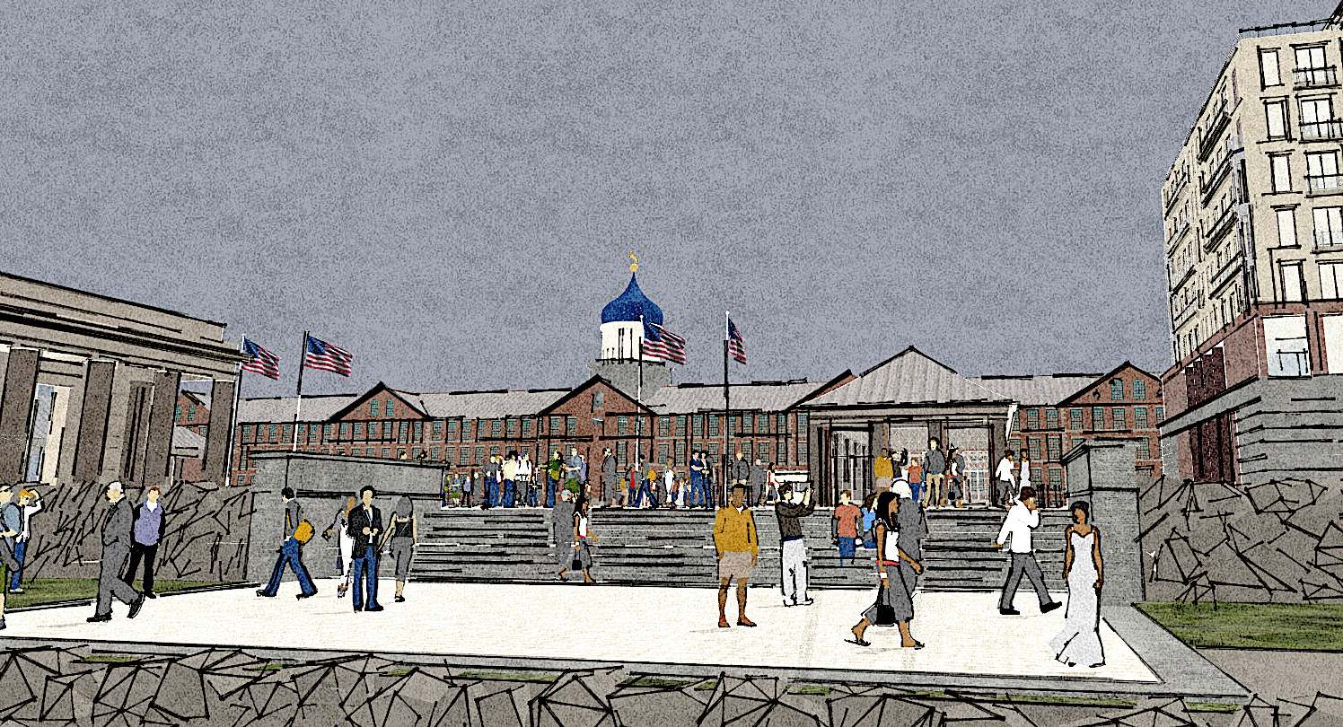
South of downtown, and also along the river, Envision Hartford’s second investigation envisions transforming the area around the historic Colt Armory. Distinguished by its iconic blue onion dome, and for producing Samuel Colt's celebrated revolving firearm, the Armory stands as a testament to Hartford’s venerable machine-tool and manufacturing history.
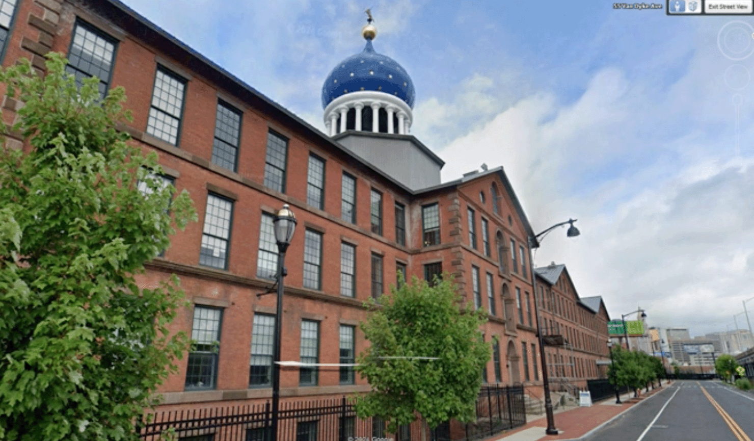
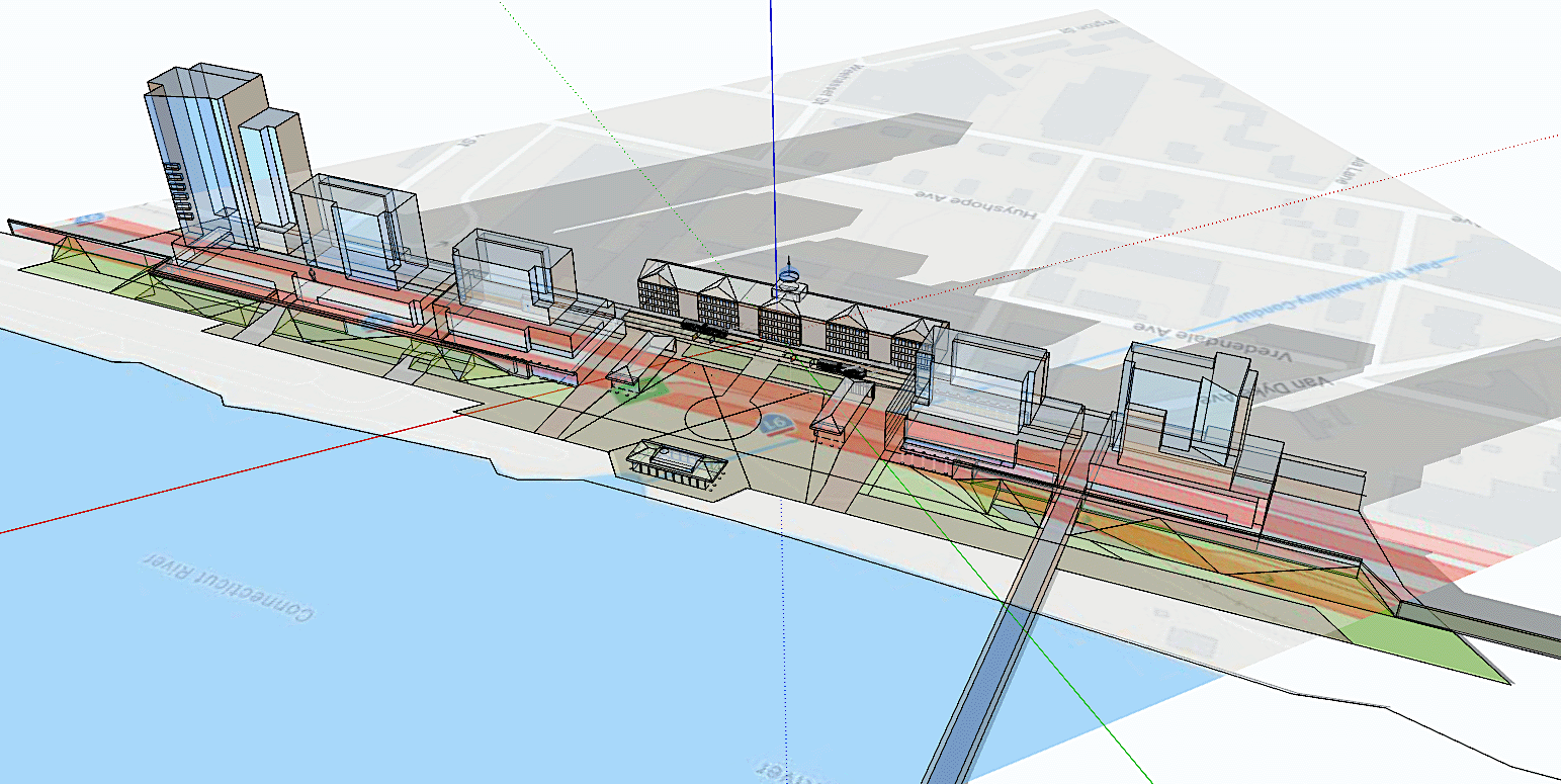
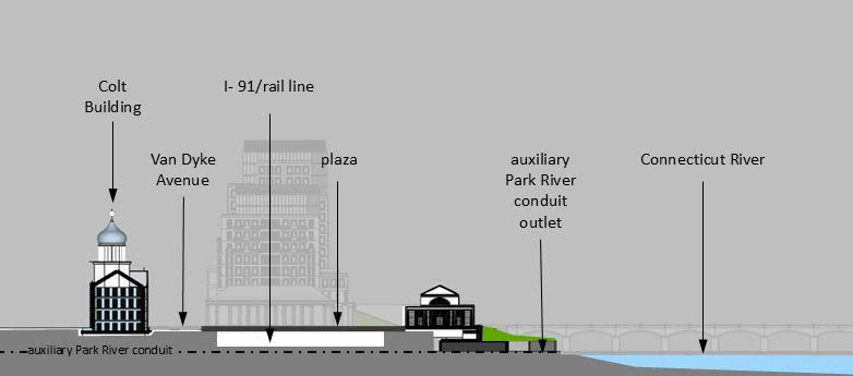
Recently renovated as housing and maker space by Colt Gateway Management Company through a former Chevron Corporation finance subsidiary— the Armory is now home to the Thomas Hooker Brewery. However, the landmark remains severed from river access—and the attractive Charter Oak Landing Park—by I-91. Like Crescent, Envision Hartford boldly imagines Colt as an expanded civic gathering and access point by depressing I-91 for mixed-use air-rights development over the highway immediately adjoining the Armory.
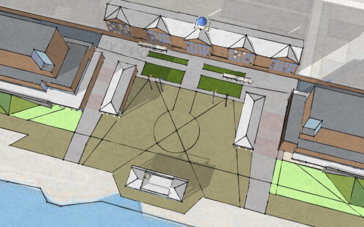
Dubbed Colt Commons, the vision includes mid-rise housing, hotels, and office/retail space set above a tunnel structure with an at-grade civic plaza, market sheds, and public swimming facility. The design incorporates new earth-berms and retractable steel floodgates similar to those erected recently in Lower Manhattan to protect against 200-year storm-events. The intent is to develop a revenue-bearing signature destination where residents, workers and visitors alike can more readily access Hartford’s southernmost riverfront by showcasing one its most familiar historic landmarks.
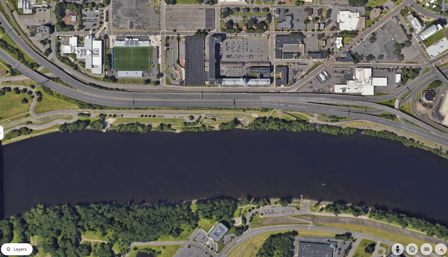
Just northwest of the Armory site lies the Whitehead Highway, a legacy of New York planner Robert Moses that entombed the Park River and severed access to several important civic sites. Envision Hartford is exploring how this segment can transform into an urban boulevard, restoring the Park River where feasible; encouraging new development to infill missing street edges, and activating surrounding public spaces, all conducive to expanding the nearby Connecticut Convention Center and UConn Hartford campus.
The road ahead
Envision Hartford rejects the notion that smaller cities must accept decline. With its strategic location, quality of life, and historical depth, Hartford can compete at a metropolitan scale—provided it embraces equitable, forward-looking planning and urban design that reach more of Hartford’s historically impacted communities.
Through presentations to Congressman Larson’s office, communication with the nonprofit Riverfront Recapture team, and ongoing outreach to regional leaders such as East Hartford Mayor Connor Martin and other community leaders, Envision Hartford is advancing its people-first visions for infrastructure and land use. With continued dialogue and creative planning input, the group believes ConnDOT can deliver a bold, pro-urban legacy worthy of the region’s time and treasure.
Envision Hartford Working Group
Bill Mocarsky – Transportation Planning & Placemaking
Micah Kerr – Regional Planning and Market Analysis
Matthew Mocarsky – Community Relations & Outreach
Fernando Silva – Architectural Illustration (Colt Armory)
Michael Tyrrell – Architecture, Planning and Urban Design
Disclaimer: The views and opinions expressed in this article are those of the Envision Hartford Working Group and do not necessarily reflect the views or positions of any entities cited within. Minor portions of this article were previously published in Traditional Building magazine.