
An alternative to a ‘wall’ in Charleston


Low-lying cities all over the East Coast need to protect their coastlines to prepare for storm surges and rising seas of climate change. Will they do it in a way that enhances or detracts from the city’s public realm, economy, and connection to the water?
In 2018, following a 10-foot storm surge from Hurricane Irma in Charleston, South Carolina (the city’s third highest ever), the US Army Corps of Engineers (USACE) conducted a coastal risk management study, resulting in a proposed 12-foot-elevation protective barrier. While needed to protect the peninsula, the project “is riddled with potentially devastating impacts to the growth and vitality” of Charleston, according to Allen Davis, director of the city’s design division.
The Corps’ proposal is effectively a wall around the seven-mile perimeter of historic city—potentially affecting use of the waterfront, tourism, businesses, mobility, and active recreation (and therefore health).
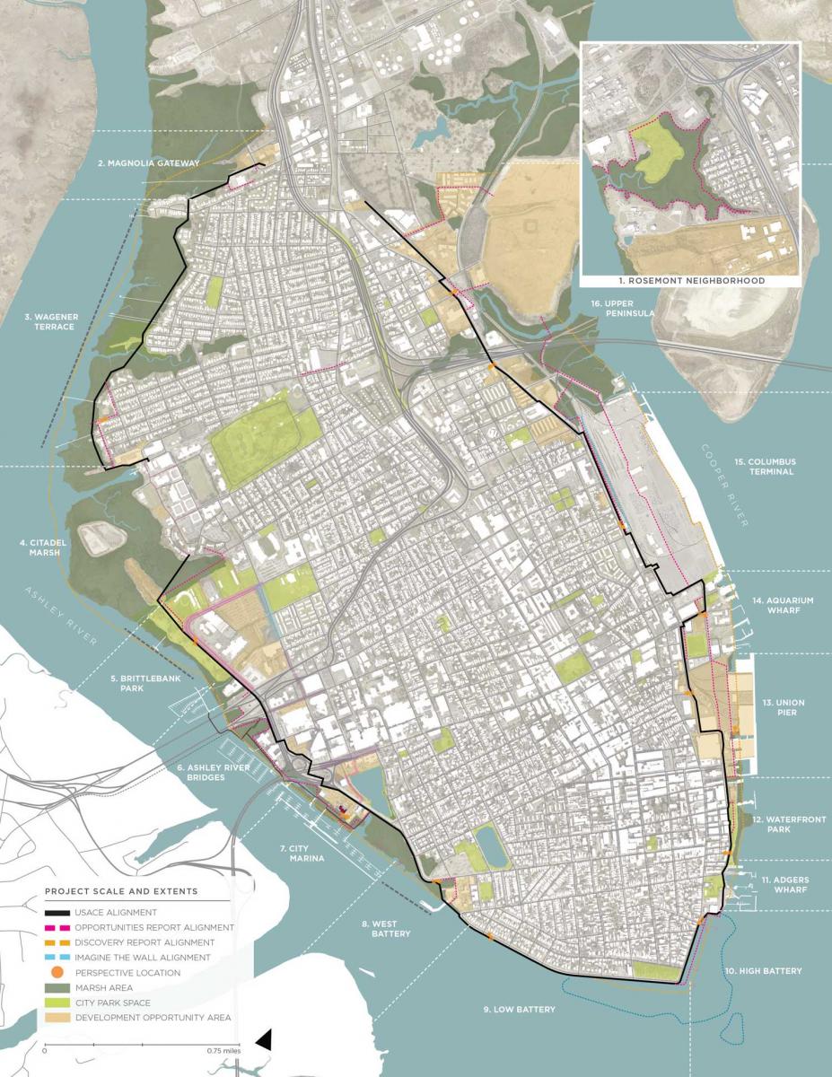
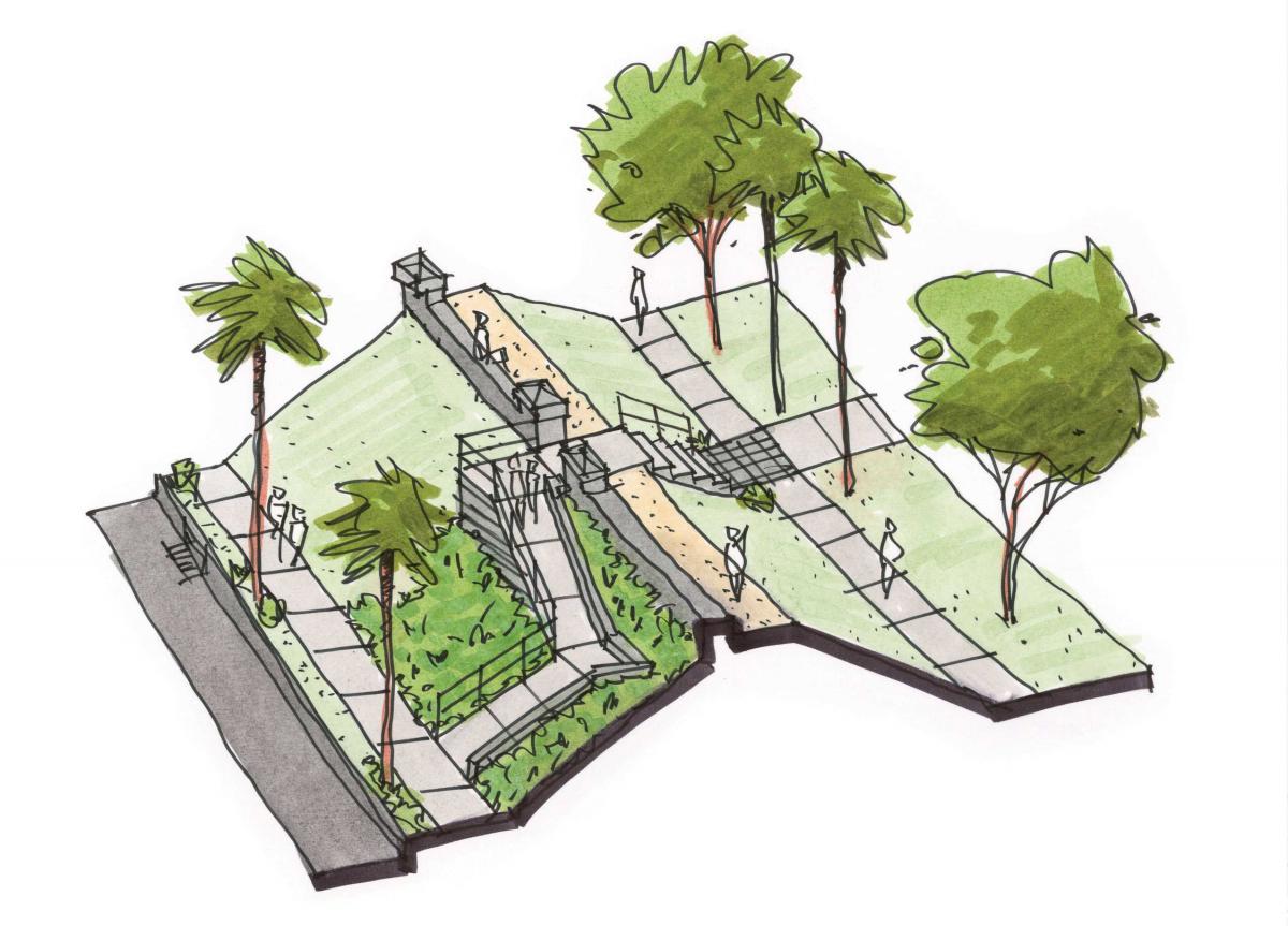
Alternatively, Charleston employed urban design solutions in its response, the Civic Design Opportunities Report, for a more nuanced take on what is appropriate. The report divides the peninsula perimeter into 16 “character segments” by natural geography, building uses, and implementation strategy. At the same time, the design team pushed for a wider range of barrier types including Batteries (steel walls backfilled with soil), berms, removable panels, breakwaters, and “living shorelines.” The goal is to combine storm protection with a civic asset, positively impacting the city’s health and economy. “Future generations depend on us to get it right,” the city says.
The solution must be inventive, multipurpose, and beautiful, the city argues. High expectations for civic design are imbedded in the city’s approach since at least the 1970s—based on appreciation of its extraordinary architecture and urbanism.
The study area covers 7.8 miles around the Charleston Peninsula, encompassing the heart of the city—roughly 1,000 acres. The peninsula is one of the most historic urban areas in the US. About 80 percent of the project “provides an experiential civic asset to Charleston, through recreation, water management, beautification, and storm surge protection,” the city reports. The other 20 percent exists as natural areas inaccessible to the public, but still provides storm protection and water management utility. From an economic standpoint, hardening the perimeter will safeguard regional job centers like the historic core, Medical District, and other critical employment areas. “This will be public space, and has to satisfy public needs,” says New Orleans architect David Waggonner, who advised Charleston and is well known for coastal resilience designs.
The project study area includes six city parks. The work proposes the edge to be a “green loop” for pedestrians and bicyclists, increasing citizen access to the waterfront. In addition, the edge contains many spits of land and rail spurs that are special, valued, and worthy of preservation, the city says.
The report paid close attention to how the barrier would impact the city at eye level, whether the view of the water would be eliminated, retail businesses would suffer, and mobility would be impacted. The issues go well beyond aesthetics to the experience of residents and visitors. Design solutions largely preserve access to, and views of, the water.
All of the city’s work is intended to show the civic value of design alternatives and educate the public on the scale and impacts of the project. “The document has been received by USACE and the community as a pathway forward,” the city notes.
Editor's note: This article addresses CNU’s Strategic Plan goal of advancing design strategies that help communities adapt to climate change and mitigate its future impact.
