City wants to transform 14 miles of ‘stroad’


Plan El Paso—a groundbreaking new urban comprehensive plan—has been in place for a decade, and still the Texas city is rolling out implementation plans.
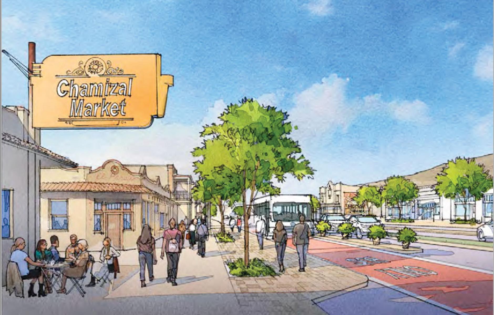
The latest is Onward Alameda, the vision to transform a 14-mile-long section of “stroad,” adopted by City Council last week.
“The Alameda Corridor has historically been one of El Paso’s most vital corridors but it has seen years of decline. Alameda Avenue connects downtown El Paso to the Mission Valley and then continues beyond the City to communities further along the Rio Grande River,” notes the planning firm Dover Kohl.
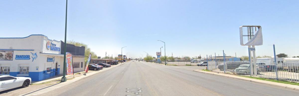
From the start of the Plan El Paso planning process, officials focused on the city’s corridors, many of which were developed with streetcars. Through mid-20th Century transportation planning, these one-time streets devolved into stroads, which combine high-speed geometries of roads with the complexity of streets.
The city's vision calls for tree-lined boulevards, which accommodate alternative modes of transportation like walking, bicycling, and transit.
Alameda Avenue means “tree-lined street” in Spanish, Dover Kohl reports. But the thoroughfare is graced by very few trees today. Trees will be planted up and down the corridor, while zoning policies will allow for mixed-use, higher-density development supported by transit. Improved bus transit service, Alameda Brio, was implemented on the corridor in 2019.
The plan encourages the use of the SmartCode on parcels along the corridor. El Paso adopted the SmartCode in 2008 for new development outside of downtown, and several major projects have been built. Alameda Avenue involves redevelopment of infill sites or suburban retrofit.
“There are two conditions in which TOD supportive zoning can be applied along the corridor,” according to Onward Alameda. “The first is to areas that already have a walkable block and street network. Here the code will govern what gets built on existing parcels. The second, is to apply the code to transform an area from a suburban or industrial area into one with a walkable pattern of lots, blocks and streets. This application involves the creation of new streets, parks, and other public amenities, in addition to the eventual buildings.”
The potential for this plan to impact the city is significant, because it is such a long corridor that links many neighborhoods together. The plan offers five Big Ideas:
- Create complete and healthy neighborhoods with a variety of housing choices
- Re-imagine streets as great public spaces, enhance mobility, and increase connectivity
- Become a leader in green energy and sustainability and address stormwater
- Create capacity and structure for implementing the plan
- Build upon existing strengths and focus efforts on a few places
The plan calls for implementation beginning with public investments that support new walkable, private-sector development.
